Tacupa geodata
Tacupa (Michoacán) is a populated place; located in Mexico in America/Mexico_City (GMT-6) time zone. With population of 616 people, there are 13995 cities with bigger population in this country. Compared to other cities in Mexico, 73.7% of cities are located further ↑North; 70.9% of cities are located further →East and 74.3% of cities have higher elevation than Tacupa. Note1


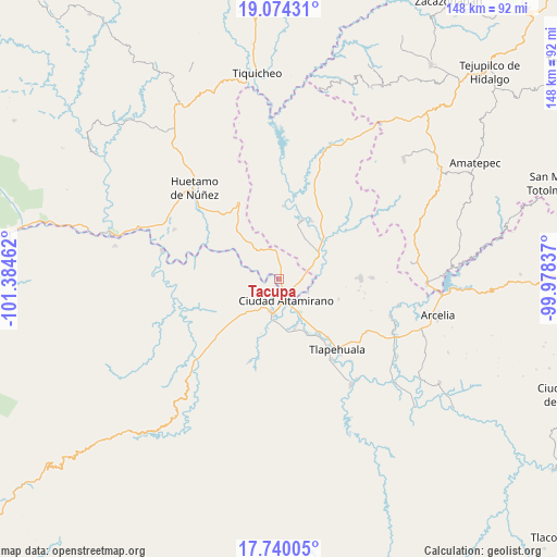
Tacupa GPS coordinates[2]
18° 24' 30.492" North, 100° 40' 53.364" West
| Map corner | latitude | longitude |
|---|---|---|
| Upper-left | 19.07431°, | -101.38462° |
| Center: | 18.40847°, | -100.68149° |
| Lower-right: | 17.74005°, | -99.97837° |
| Map W x H: | 148.4×148.4 km | = 92.2×92.2mi |
| max Lat: | 32.7° ⇑73.7% North |
| Tacupa: | 18.40847° |
| min Lat: | ⇓26.3% South 14.53588° |
| min Long | Tacupa | max Long |
| -117.105° | -100.68149° | -86.73105° |
| W 29.1%⇐ | ⇒70.9% E |
Elevation
Elevation of Tacupa is 244 m = 801 ft, and this is 1009.7 m = 3313 ft below average elevation for this country.
| Max E: |
3497 m = 11473 ft | 74.3% |
| Avg. | 1253.7 m = 4113 ft | |
| Tacupa | 244 m = 801 ft | |
Min E: |
-1 m = -3 ft | 25.7% |
See also: Mexico elevation on elevation.city.
Geographical zone
Tacupa is located in North Torrid zone (between Equator and Tropic of Cancer). Distance of this Northern Tropic circle is 559.1 km =347.4 mi to North.| Distance of | km | miles | from Tacupa |
|---|---|---|---|
| North Pole | 7960.2 | 4946.2 | to North |
| Arctic Circle | 5354.3 | 3327 | to North |
| Tropic Cancer | 559.1 | 347.4 | to North |
| Equator | 2046.8 | 1271.8 | to South |


Nearby cities:
15 places around Tacupa: (largest is in red/bold)
• Ciudad Altamirano
5.7 km =3.5 mi,  167°
167°
• Coyuca de Catalán
9.3 km =5.8 mi,  191°
191°
• La Bajada
10 km =6.2 mi, 174°
• La Bolsa
9.1 km =5.7 mi,  97°
97°
• Las Tinajas
6.3 km =3.9 mi,  206°
206°
• Los Limones
8.2 km =5.1 mi,  140°
140°
• Querendas
8.9 km =5.5 mi,  145°
145°
• Río Florido (Las Ánimas)
3.5 km =2.2 mi,  217°
217°
• Salguero
5.9 km =3.7 mi,  84°
84°
• San Jerónimo
3.3 km =2.1 mi,  162°
162°
• Santa Bárbara
9.7 km =6 mi, 153°
• Santa Cruz de Villa Gómez
6.5 km =4 mi,  124°
124°
• Santo Domingo
5.1 km =3.2 mi,  261°
261°
• Tamácuaro
10.2 km =6.3 mi,  18°
18°
• Tierra Blanca
8.5 km =5.3 mi, 185°
Sources, notices
• [Note1] Compared only with cities in Mexico existing in our database
• [Src1] Map data: © OpenStreetMap contributors (CC-BY-SA)
• [Src2] Other city data from geonames.org with taken over terms of usage.
• [Src3] Geographical zone / Annual Mean Temperature by Robert A. Rohde @ Wikipedia
