La Bolsa geodata
La Bolsa (Guerrero) is a populated place; located in Mexico in America/Mexico_City (GMT-6) time zone. With population of 588 people, there are 14598 cities with bigger population in this country. Compared to other cities in Mexico, 73.8% of cities are located further ↑North; 70.3% of cities are located further →East and 73.7% of cities have higher elevation than La Bolsa. Note1


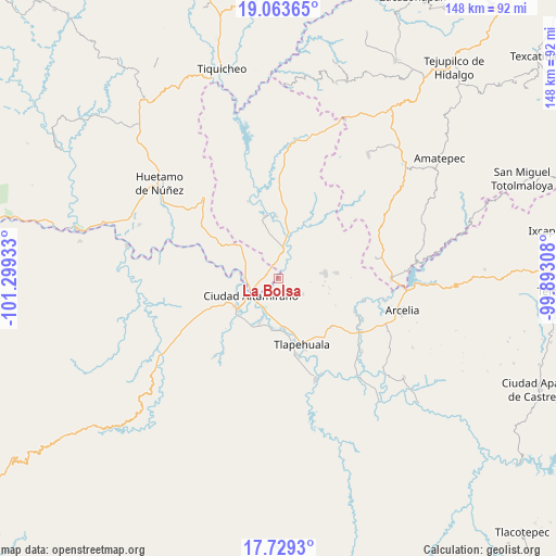
La Bolsa GPS coordinates[2]
18° 23' 51.972" North, 100° 35' 46.32" West
| Map corner | latitude | longitude |
|---|---|---|
| Upper-left | 19.06365°, | -101.29933° |
| Center: | 18.39777°, | -100.5962° |
| Lower-right: | 17.7293°, | -99.89308° |
| Map W x H: | 148.4×148.4 km | = 92.2×92.2mi |
| max Lat: | 32.7° ⇑73.8% North |
| La Bolsa: | 18.39777° |
| min Lat: | ⇓26.2% South 14.53588° |
| min Long | La Bolsa | max Long |
| -117.105° | -100.5962° | -86.73105° |
| W 29.7%⇐ | ⇒70.3% E |
Elevation
Elevation of La Bolsa is 266 m = 873 ft, and this is 987.7 m = 3240 ft below average elevation for this country.
| Max E: |
3497 m = 11473 ft | 73.7% |
| Avg. | 1253.7 m = 4113 ft | |
| La Bolsa | 266 m = 873 ft | |
Min E: |
-1 m = -3 ft | 26.3% |
See also: Mexico elevation on elevation.city.
Geographical zone
La Bolsa is located in North Torrid zone (between Equator and Tropic of Cancer). Distance of this Northern Tropic circle is 560.3 km =348.2 mi to North.| Distance of | km | miles | from La Bolsa |
|---|---|---|---|
| North Pole | 7961.4 | 4947 | to North |
| Arctic Circle | 5355.5 | 3327.8 | to North |
| Tropic Cancer | 560.3 | 348.2 | to North |
| Equator | 2045.6 | 1271.1 | to South |


Nearby cities:
15 places around La Bolsa: (largest is in red/bold)
• Chacamerito
8.5 km =5.3 mi,  174°
174°
• Ciudad Altamirano
8.9 km =5.5 mi,  240°
240°
• Cuadrilla Nueva
4.7 km =2.9 mi,  33°
33°
• Cutzamala de Pinzón
8 km =5 mi,  11°
11°
• La Bajada
11.8 km =7.3 mi,  222°
222°
• Los Limones
6.4 km =4 mi, 216°
• Querendas
7.4 km =4.6 mi,  213°
213°
• Río Florido (Las Ánimas)
11.2 km =7 mi,  261°
261°
• Salguero
3.6 km =2.2 mi,  300°
300°
• San Jerónimo
8.2 km =5.1 mi, 256°
• Santa Bárbara
8.8 km =5.5 mi, 211°
• Santa Cruz de Villa Gómez
4.4 km =2.7 mi, 235°
• Tacupa
9.1 km =5.7 mi,  277°
277°
• Tamácuaro
12.3 km =7.6 mi,  331°
331°
• Tierra Blanca
12.2 km =7.6 mi,  233°
233°
Sources, notices
• [Note1] Compared only with cities in Mexico existing in our database
• [Src1] Map data: © OpenStreetMap contributors (CC-BY-SA)
• [Src2] Other city data from geonames.org with taken over terms of usage.
• [Src3] Geographical zone / Annual Mean Temperature by Robert A. Rohde @ Wikipedia
