Tutuapan geodata
Tutuapan (State of Mexico) is a populated place; located in Mexico in America/Mexico_City (GMT-6) time zone. With population of 693 people, there are 12564 cities with bigger population in this country. Compared to other cities in Mexico, 60.2% of cities are located further ↑North; 67.1% of cities are located further →East and 60.1% of cities have lower elevation than Tutuapan. Note1


Tutuapan GPS coordinates[2]
19° 14' 12.984" North, 100° 16' 3.36" West
| Map corner | latitude | longitude |
|---|---|---|
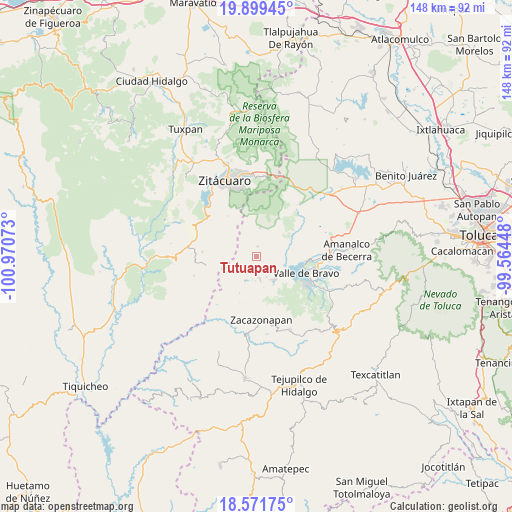
| Upper-left | 19.89945°, | -100.97073° |
| Center: | 19.23694°, | -100.2676° |
| Lower-right: | 18.57175°, | -99.56448° |
| Map W x H: | 147.6×147.6 km | = 91.7×91.7mi |
| max Lat: | 32.7° ⇑60.2% North |
| Tutuapan: | 19.23694° |
| min Lat: | ⇓39.8% South 14.53588° |
| min Long | Tutuapan | max Long |
| -117.105° | -100.2676° | -86.73105° |
| W 32.9%⇐ | ⇒67.1% E |
Elevation
Elevation of Tutuapan is 1727 m = 5666 ft, and this is 473.3 m = 1553 ft above average elevation for this country.
| Max E: |
3497 m = 11473 ft | 39.9% |
| Tutuapan | 1727 m 5666 ft | |
| Avg. | 1253.7 m = 4113 ft | |
Min E: |
-1 m = -3 ft | 60.1% |
See also: Mexico elevation on elevation.city.
Geographical zone
Tutuapan is located in North Torrid zone (between Equator and Tropic of Cancer). Distance of this Northern Tropic circle is 467 km =290.2 mi to North.| Distance of | km | miles | from Tutuapan |
|---|---|---|---|
| North Pole | 7868.1 | 4889 | to North |
| Arctic Circle | 5262.2 | 3269.8 | to North |
| Tropic Cancer | 467 | 290.2 | to North |
| Equator | 2138.9 | 1329.1 | to South |


Nearby cities:
15 places around Tutuapan: (largest is in red/bold)
• Colorines
8.3 km =5.2 mi,  141°
141°
• Dolores (Ex-Hacienda de Dolores)
8.2 km =5.1 mi,  273°
273°
• El Durazno
8.1 km =5 mi,  121°
121°
• El Sifón
7.6 km =4.7 mi,  150°
150°
• Frontón Vivero
8.1 km =5 mi, 146°
• Ixtapan del Oro
2.9 km =1.8 mi,  6°
6°
• Las Fincas
7.1 km =4.4 mi,  171°
171°
• Loma Bonita
7.8 km =4.8 mi, 135°
• Miahuatlán de Hidalgo (Santa Cruz Miahuatlán)
7.7 km =4.8 mi,  339°
339°
• San Juan Xoconusco
8.3 km =5.2 mi, 5°
• San Martín Ocoxochitepec (San Martín)
3.8 km =2.4 mi, 10°
• San Nicolás Tolentino
6.4 km =4 mi, 154°
• Santa Teresa Tiloxtoc
7.3 km =4.5 mi,  97°
97°
• Santiago Huitlapaltepec
8.5 km =5.3 mi,  49°
49°
• Santo Tomás de los Plátanos
6 km =3.7 mi, 172°
Sources, notices
• [Note1] Compared only with cities in Mexico existing in our database
• [Src1] Map data: © OpenStreetMap contributors (CC-BY-SA)
• [Src2] Other city data from geonames.org with taken over terms of usage.
• [Src3] Geographical zone / Annual Mean Temperature by Robert A. Rohde @ Wikipedia
