Coyuquilla Norte geodata
Coyuquilla Norte (Guerrero) is a populated place; located in Mexico in America/Mexico_City (GMT-6) time zone. With population of 1,507 people, there are 5723 cities with bigger population in this country. Compared to other cities in Mexico, 84.4% of cities are located further ↑North; 73.9% of cities are located further →East and 84.3% of cities have higher elevation than Coyuquilla Norte. Note1


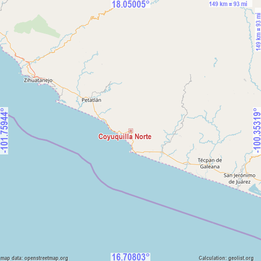
Coyuquilla Norte GPS coordinates[2]
17° 22' 48.972" North, 101° 3' 22.716" West
| Map corner | latitude | longitude |
|---|---|---|
| Upper-left | 18.05005°, | -101.75944° |
| Center: | 17.38027°, | -101.05631° |
| Lower-right: | 16.70803°, | -100.35319° |
| Map W x H: | 149.2×149.2 km | = 92.7×92.7mi |
| max Lat: | 32.7° ⇑84.4% North |
| Coyuquilla Norte: | 17.38027° |
| min Lat: | ⇓15.6% South 14.53588° |
| min Long | Coyuquilla Nort | max Long |
| -117.105° | -101.05631° | -86.73105° |
| W 26.1%⇐ | ⇒73.9% E |
Elevation
Elevation of Coyuquilla Norte is 50 m = 164 ft, and this is 1203.7 m = 3949 ft below average elevation for this country.
| Max E: |
3497 m = 11473 ft | 84.3% |
| Avg. | 1253.7 m = 4113 ft | |
| Coyuquilla Norte | 50 m = 164 ft | |
Min E: |
-1 m = -3 ft | 15.7% |
See also: Mexico elevation on elevation.city.
Geographical zone
Coyuquilla Norte is located in North Torrid zone (between Equator and Tropic of Cancer). Distance of this Northern Tropic circle is 673.4 km =418.4 mi to North.| Distance of | km | miles | from Coyuquilla Norte |
|---|---|---|---|
| North Pole | 8074.6 | 5017.3 | to North |
| Arctic Circle | 5468.7 | 3398.1 | to North |
| Tropic Cancer | 673.4 | 418.4 | to North |
| Equator | 1932.5 | 1200.8 | to South |


Nearby cities:
15 places around Coyuquilla Norte: (largest is in red/bold)
• Colonia Veinte de Noviembre (El Veinte)
33.8 km =21 mi,  122°
122°
• Coyuquilla Sur (Coyuquilla Viejo)
2.8 km =1.7 mi,  210°
210°
• El Mameyal
24.2 km =15 mi,  15°
15°
• El Zarco
45.7 km =28.4 mi,  305°
305°
• Las Mesas
14.9 km =9.3 mi,  0°
0°
• Los Achotes
45.5 km =28.3 mi,  302°
302°
• Nuxco
37.1 km =23.1 mi, 120°
• Palos Blancos
35.3 km =21.9 mi, 304°
• Papanoa
6.3 km =3.9 mi,  165°
165°
• Petatlán
28.5 km =17.7 mi, 307°
• Rancho Alegre del Llano (El Llano)
16.3 km =10.1 mi,  138°
138°
• Rodecia
42.4 km =26.3 mi, 116°
• San Jeronimito
37.1 km =23.1 mi, 304°
• San Luis San Pedro
22.6 km =14 mi, 124°
• San Luis de La Loma
21.2 km =13.2 mi,  125°
125°
Sources, notices
• [Note1] Compared only with cities in Mexico existing in our database
• [Src1] Map data: © OpenStreetMap contributors (CC-BY-SA)
• [Src2] Other city data from geonames.org with taken over terms of usage.
• [Src3] Geographical zone / Annual Mean Temperature by Robert A. Rohde @ Wikipedia
