San Luis San Pedro geodata
San Luis San Pedro (Guerrero) is a populated place; located in Mexico in America/Mexico_City (GMT-6) time zone. With population of 4,236 people, there are 2169 cities with bigger population in this country. Compared to other cities in Mexico, 85.7% of cities are located further ↑North; 72.5% of cities are located further →East and 89.7% of cities have higher elevation than San Luis San Pedro. Note1


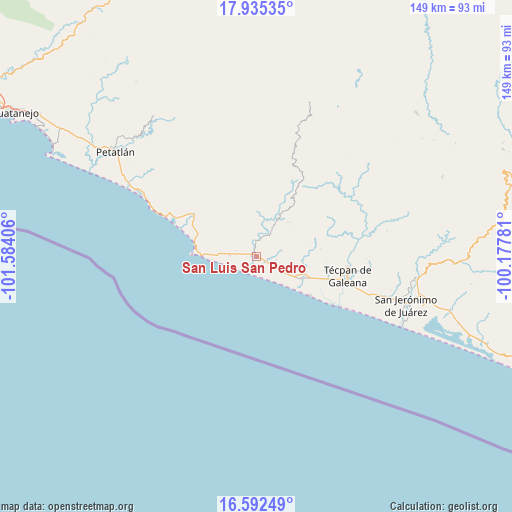
San Luis San Pedro GPS coordinates[2]
17° 15' 54.504" North, 100° 52' 51.348" West
| Map corner | latitude | longitude |
|---|---|---|
| Upper-left | 17.93535°, | -101.58406° |
| Center: | 17.26514°, | -100.88093° |
| Lower-right: | 16.59249°, | -100.17781° |
| Map W x H: | 149.3×149.3 km | = 92.8×92.8mi |
| max Lat: | 32.7° ⇑85.7% North |
| San Luis San Pedro: | 17.26514° |
| min Lat: | ⇓14.3% South 14.53588° |
| min Long | San Luis San Pe | max Long |
| -117.105° | -100.88093° | -86.73105° |
| W 27.5%⇐ | ⇒72.5% E |
Elevation
Elevation of San Luis San Pedro is 25 m = 82 ft, and this is 1228.7 m = 4031 ft below average elevation for this country.
| Max E: |
3497 m = 11473 ft | 89.7% |
| Avg. | 1253.7 m = 4113 ft | |
| San Luis San Pedro | 25 m = 82 ft | |
Min E: |
-1 m = -3 ft | 10.3% |
See also: Mexico elevation on elevation.city.
Geographical zone
San Luis San Pedro is located in North Torrid zone (between Equator and Tropic of Cancer). Distance of this Northern Tropic circle is 686.2 km =426.4 mi to North.| Distance of | km | miles | from San Luis San Pedro |
|---|---|---|---|
| North Pole | 8087.4 | 5025.3 | to North |
| Arctic Circle | 5481.5 | 3406 | to North |
| Tropic Cancer | 686.2 | 426.4 | to North |
| Equator | 1919.7 | 1192.8 | to South |


Nearby cities:
15 places around San Luis San Pedro: (largest is in red/bold)
• Colonia Veinte de Noviembre (El Veinte)
11.2 km =7 mi,  119°
119°
• Coyuquilla Norte
22.6 km =14 mi,  304°
304°
• Coyuquilla Sur (Coyuquilla Viejo)
22.5 km =14 mi, 297°
• El Súchil
26 km =16.2 mi,  99°
99°
• Las Mesas
33.3 km =20.7 mi,  326°
326°
• Nuxco
14.6 km =9.1 mi, 115°
• Papanoa
18.3 km =11.4 mi,  291°
291°
• Rancho Alegre del Llano (El Llano)
7.7 km =4.8 mi,  274°
274°
• Rodecia
20.2 km =12.6 mi,  108°
108°
• San Luis de La Loma
1.5 km =0.9 mi, 291°
• Santa María
33.1 km =20.6 mi, 96°
• Tenexpa
24 km =14.9 mi, 111°
• Tetitlán
28.2 km =17.5 mi, 114°
• Técpan de Galeana
27.1 km =16.8 mi, 100°
• Villa Rotaria
23.8 km =14.8 mi, 109°
Sources, notices
• [Note1] Compared only with cities in Mexico existing in our database
• [Src1] Map data: © OpenStreetMap contributors (CC-BY-SA)
• [Src2] Other city data from geonames.org with taken over terms of usage.
• [Src3] Geographical zone / Annual Mean Temperature by Robert A. Rohde @ Wikipedia
