La Barreta geodata
La Barreta (Querétaro) is a populated place; located in Mexico in America/Mexico_City (GMT-6) time zone. With population of 1,223 people, there are 7100 cities with bigger population in this country. Compared to other cities in Mexico, 73.7% of cities are located further ↓South; 69.6% of cities are located further →East and 80.8% of cities have lower elevation than La Barreta. Note1


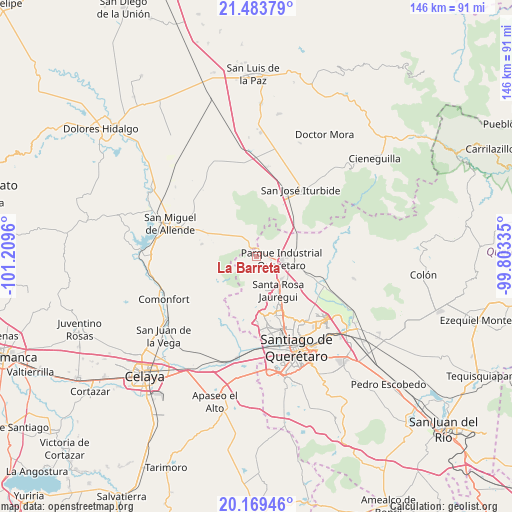
La Barreta GPS coordinates[2]
20° 49' 41.016" North, 100° 30' 23.292" West
| Map corner | latitude | longitude |
|---|---|---|
| Upper-left | 21.48379°, | -101.2096° |
| Center: | 20.82806°, | -100.50647° |
| Lower-right: | 20.16946°, | -99.80335° |
| Map W x H: | 146.1×146.1 km | = 90.8×90.8mi |
| max Lat: | 32.7° ⇑26.3% North |
| La Barreta: | 20.82806° |
| min Lat: | ⇓73.7% South 14.53588° |
| min Long | La Barreta | max Long |
| -117.105° | -100.50647° | -86.73105° |
| W 30.4%⇐ | ⇒69.6% E |
Elevation
Elevation of La Barreta is 2160 m = 7087 ft, and this is 906.3 m = 2973 ft above average elevation for this country.
| Max E: |
3497 m = 11473 ft | 19.2% |
| La Barreta | 2160 m 7087 ft | |
| Avg. | 1253.7 m = 4113 ft | |
Min E: |
-1 m = -3 ft | 80.8% |
See also: Mexico elevation on elevation.city.
Geographical zone
La Barreta is located in North Torrid zone (between Equator and Tropic of Cancer). Distance of this Northern Tropic circle is 290.1 km =180.3 mi to North.| Distance of | km | miles | from La Barreta |
|---|---|---|---|
| North Pole | 7691.2 | 4779.1 | to North |
| Arctic Circle | 5085.3 | 3159.9 | to North |
| Tropic Cancer | 290.1 | 180.3 | to North |
| Equator | 2315.9 | 1439 | to South |


Nearby cities:
15 places around La Barreta: (largest is in red/bold)
• Buenavista
3.8 km =2.4 mi,  97°
97°
• Cerro Colorado (El Colorado)
7.4 km =4.6 mi,  174°
174°
• Cerro de la Cruz
1.6 km =1 mi,  159°
159°
• Corea
6.6 km =4.1 mi,  116°
116°
• Estancia de la Rochera
6.3 km =3.9 mi,  181°
181°
• La Carbonera
2.5 km =1.6 mi, 174°
• La Luz
8.4 km =5.2 mi,  57°
57°
• La Monja
1.9 km =1.2 mi,  29°
29°
• Moral de Puerto de Nieto
7.3 km =4.5 mi,  354°
354°
• Pie de Gallo
5.2 km =3.2 mi, 163°
• Puerto de Aguirre
8.1 km =5 mi,  107°
107°
• Puerto de Nieto
7.6 km =4.7 mi,  334°
334°
• San Isidro Buenavista
7.4 km =4.6 mi,  126°
126°
• Santa Catarina
8 km =5 mi,  135°
135°
• Santas Marías
6.8 km =4.2 mi,  323°
323°
Sources, notices
• [Note1] Compared only with cities in Mexico existing in our database
• [Src1] Map data: © OpenStreetMap contributors (CC-BY-SA)
• [Src2] Other city data from geonames.org with taken over terms of usage.
• [Src3] Geographical zone / Annual Mean Temperature by Robert A. Rohde @ Wikipedia
