Mezquite Mata del Tigre geodata
Mezquite Mata del Tigre (Veracruz) is a populated place; located in Mexico in America/Mexico_City (GMT-6) time zone. With population of 514 people, there are 16370 cities with bigger population in this country. Compared to other cities in Mexico, 80.9% of cities are located further ↓South; 60.8% of cities are located further ←West and 77.3% of cities have higher elevation than Mezquite Mata del Tigre. Note1
Current local time in Mezquite Mata del Tigre:
12:34 PM, MondayDifference from your time zone: hours


Mezquite Mata del Tigre GPS coordinates[2]
21° 24' 19.008" North, 98° 13' 44.004" West
| Map corner | latitude | longitude |
|---|---|---|
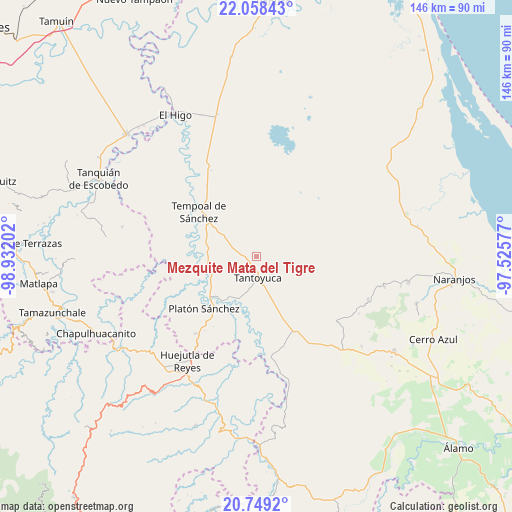
| Upper-left | 22.05843°, | -98.93202° |
| Center: | 21.40528°, | -98.22889° |
| Lower-right: | 20.7492°, | -97.52577° |
| Map W x H: | 145.6×145.6 km | = 90.5×90.5mi |
| max Lat: | 32.7° ⇑19.1% North |
| Mezquite Mata del Tigre: | 21.40528° |
| min Lat: | ⇓80.9% South 14.53588° |
| min Long | Mezquite Mata d | max Long |
| -117.105° | -98.22889° | -86.73105° |
| W 60.8%⇐ | ⇒39.2% E |
Elevation
Elevation of Mezquite Mata del Tigre is 146 m = 479 ft, and this is 1107.7 m = 3634 ft below average elevation for this country.
| Max E: |
3497 m = 11473 ft | 77.3% |
| Avg. | 1253.7 m = 4113 ft | |
| Mezquite Mata del Tigre | 146 m = 479 ft | |
Min E: |
-1 m = -3 ft | 22.7% |
See also: Mexico elevation on elevation.city.
Geographical zone
Mezquite Mata del Tigre is located in North Torrid zone (between Equator and Tropic of Cancer). Distance of this Northern Tropic circle is 225.9 km =140.4 mi to North.| Distance of | km | miles | from Mezquite Mata del Tigre |
|---|---|---|---|
| North Pole | 7627 | 4739.2 | to North |
| Arctic Circle | 5021.1 | 3120 | to North |
| Tropic Cancer | 225.9 | 140.4 | to North |
| Equator | 2380 | 1478.9 | to South |


Nearby cities:
15 places around Mezquite Mata del Tigre: (largest is in red/bold)
• Cerro Botica
3.9 km =2.4 mi,  279°
279°
• Cuchilla Chica
7.5 km =4.7 mi,  286°
286°
• El Jobo Aquiche
7.7 km =4.8 mi,  257°
257°
• El Porvenir Chopopo
7.1 km =4.4 mi,  124°
124°
• La Estanzuela
5.8 km =3.6 mi, 276°
• La Peña
8.5 km =5.3 mi, 282°
• Palma Alta
3.2 km =2 mi,  2°
2°
• Palmar Aquiche Primero
6.3 km =3.9 mi, 262°
• Placetas
5.5 km =3.4 mi,  338°
338°
• Potrero Segundo
7.1 km =4.4 mi,  216°
216°
• Rancho Nuevo
5.1 km =3.2 mi, 285°
• Tantoyuca
6.1 km =3.8 mi,  176°
176°
• Terrero
7.7 km =4.8 mi,  317°
317°
• Trapiche
6.6 km =4.1 mi,  233°
233°
• Xiloxúchitl
7.8 km =4.8 mi,  214°
214°
Sources, notices
• [Note1] Compared only with cities in Mexico existing in our database
• [Src1] Map data: © OpenStreetMap contributors (CC-BY-SA)
• [Src2] Other city data from geonames.org with taken over terms of usage.
• [Src3] Geographical zone / Annual Mean Temperature by Robert A. Rohde @ Wikipedia
