Villa Magna geodata
Villa Magna (Michoacán) is a populated place; located in Mexico in America/Mexico_City (GMT-6) time zone. With population of 4,577 people, there are 2008 cities with bigger population in this country. Compared to other cities in Mexico, 50% of cities are located further ↓South; 75.9% of cities are located further →East and 74.1% of cities have lower elevation than Villa Magna. Note1


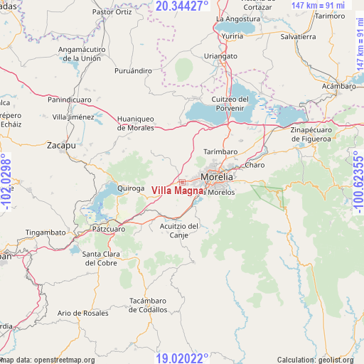
Villa Magna GPS coordinates[2]
19° 41' 0.996" North, 101° 19' 36.012" West
| Map corner | latitude | longitude |
|---|---|---|
| Upper-left | 20.34427°, | -102.0298° |
| Center: | 19.68361°, | -101.32667° |
| Lower-right: | 19.02022°, | -100.62355° |
| Map W x H: | 147.2×147.2 km | = 91.5×91.5mi |
| max Lat: | 32.7° ⇑50% North |
| Villa Magna: | 19.68361° |
| min Lat: | ⇓50% South 14.53588° |
| min Long | Villa Magna | max Long |
| -117.105° | -101.32667° | -86.73105° |
| W 24.1%⇐ | ⇒75.9% E |
Elevation
Elevation of Villa Magna is 2015 m = 6611 ft, and this is 761.3 m = 2498 ft above average elevation for this country.
| Max E: |
3497 m = 11473 ft | 25.9% |
| Villa Magna | 2015 m 6611 ft | |
| Avg. | 1253.7 m = 4113 ft | |
Min E: |
-1 m = -3 ft | 74.1% |
See also: Mexico elevation on elevation.city.
Geographical zone
Villa Magna is located in North Torrid zone (between Equator and Tropic of Cancer). Distance of this Northern Tropic circle is 417.3 km =259.3 mi to North.| Distance of | km | miles | from Villa Magna |
|---|---|---|---|
| North Pole | 7818.4 | 4858.1 | to North |
| Arctic Circle | 5212.6 | 3239 | to North |
| Tropic Cancer | 417.3 | 259.3 | to North |
| Equator | 2188.6 | 1359.9 | to South |


Nearby cities:
15 places around Villa Magna: (largest is in red/bold)
• Capula
6.9 km =4.3 mi,  260°
260°
• Conjunto Habitacional Villas del Pedregal
2.4 km =1.5 mi,  90°
90°
• Cuto de la Esperanza
5.4 km =3.4 mi,  344°
344°
• El Cerrito Itzícuaro
5.2 km =3.2 mi,  106°
106°
• Fraccionamiento San Lorenzo
5.4 km =3.4 mi, 92°
• La Concepción
2.9 km =1.8 mi,  34°
34°
• La Mintzita (Piedra Dura)
6.2 km =3.9 mi,  124°
124°
• Lomas de la Maestranza
0.6 km =0.4 mi,  318°
318°
• San Antonio
6.4 km =4 mi, 106°
• San Antonio Parangare
5.5 km =3.4 mi,  139°
139°
• San Juanito Itzícuaro
7.6 km =4.7 mi,  96°
96°
• San Lorenzo Itzícuaro
4.8 km =3 mi, 99°
• San Nicolás Obispo
3.6 km =2.2 mi,  161°
161°
• Tacicuaro
3.8 km =2.4 mi,  246°
246°
• Villas de la Loma
2.9 km =1.8 mi,  76°
76°
Sources, notices
• [Note1] Compared only with cities in Mexico existing in our database
• [Src1] Map data: © OpenStreetMap contributors (CC-BY-SA)
• [Src2] Other city data from geonames.org with taken over terms of usage.
• [Src3] Geographical zone / Annual Mean Temperature by Robert A. Rohde @ Wikipedia
