El Pedregal de Guadalupe Hidalgo geodata
El Pedregal de Guadalupe Hidalgo (State of Mexico) is a populated place; located in Mexico in America/Mexico_City (GMT-6) time zone. With population of 4,534 people, there are 2028 cities with bigger population in this country. Compared to other cities in Mexico, 59.8% of cities are located further ↑North; 56.4% of cities are located further →East and 94.9% of cities have lower elevation than El Pedregal de Guadalupe Hidalgo. Note1
Current local time in El Pedregal de Guadalupe Hidalgo:
10:04 AM, MondayDifference from your time zone: hours


El Pedregal de Guadalupe Hidalgo GPS coordinates[2]
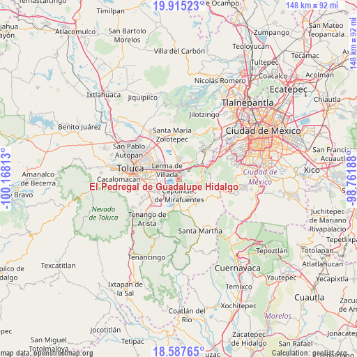
19° 15' 10.008" North, 99° 27' 54" West
| Map corner | latitude | longitude |
|---|---|---|
| Upper-left | 19.91523°, | -100.16813° |
| Center: | 19.25278°, | -99.465° |
| Lower-right: | 18.58765°, | -98.76188° |
| Map W x H: | 147.6×147.6 km | = 91.7×91.7mi |
| max Lat: | 32.7° ⇑59.8% North |
| El Pedregal de Guadalupe Hidalgo: | 19.25278° |
| min Lat: | ⇓40.2% South 14.53588° |
| min Long | El Pedregal de | max Long |
| -117.105° | -99.465° | -86.73105° |
| W 43.6%⇐ | ⇒56.4% E |
Elevation
Elevation of El Pedregal de Guadalupe Hidalgo is 2593 m = 8507 ft, and this is 1339.3 m = 4394 ft above average elevation for this country.
| Max E: |
3497 m = 11473 ft | 5.1% |
| El Pedregal de Guadalupe Hidalgo | 2593 m 8507 ft | |
| Avg. | 1253.7 m = 4113 ft | |
Min E: |
-1 m = -3 ft | 94.9% |
See also: Mexico elevation on elevation.city.
Geographical zone
El Pedregal de Guadalupe Hidalgo is located in North Torrid zone (between Equator and Tropic of Cancer). Distance of this Northern Tropic circle is 465.2 km =289.1 mi to North.| Distance of | km | miles | from El Pedregal de Guadalupe Hidalgo |
|---|---|---|---|
| North Pole | 7866.4 | 4888 | to North |
| Arctic Circle | 5260.5 | 3268.7 | to North |
| Tropic Cancer | 465.2 | 289.1 | to North |
| Equator | 2140.7 | 1330.2 | to South |


Nearby cities:
15 places around El Pedregal de Guadalupe Hidalgo: (largest is in red/bold)
• Agua Blanca
3.6 km =2.2 mi,  189°
189°
• Amomolulco
4.4 km =2.7 mi,  325°
325°
• Colonia Juárez
3.6 km =2.2 mi,  357°
357°
• Colonia el Pirame
1.5 km =0.9 mi,  208°
208°
• El Llano del Compromiso
1.5 km =0.9 mi,  278°
278°
• Fraccionamiento y Club de Golf los Encinos
4.3 km =2.7 mi,  338°
338°
• Loma Bonita
2.2 km =1.4 mi,  57°
57°
• Loma de los Esquiveles
2 km =1.2 mi,  47°
47°
• Ocoyoacac
2.2 km =1.4 mi,  20°
20°
• San Antonio el Llanito
4.2 km =2.6 mi,  311°
311°
• San Nicolás Tlazala
3 km =1.9 mi,  177°
177°
• San Pedro Chochula
2.5 km =1.6 mi,  298°
298°
• San Pedro Cholula
2.6 km =1.6 mi, 300°
• Santa Cruz Tultepec
2.9 km =1.8 mi, 192°
• Texcalpa (Ex-Hacienda Texcalpa)
1.3 km =0.8 mi, 45°
Sources, notices
• [Note1] Compared only with cities in Mexico existing in our database
• [Src1] Map data: © OpenStreetMap contributors (CC-BY-SA)
• [Src2] Other city data from geonames.org with taken over terms of usage.
• [Src3] Geographical zone / Annual Mean Temperature by Robert A. Rohde @ Wikipedia
