San Nicolás Tlazala geodata
San Nicolás Tlazala (Morelos) is a populated place; located in Mexico in America/Mexico_City (GMT-6) time zone. With population of 4,578 people, there are 2007 cities with bigger population in this country. Compared to other cities in Mexico, 60.5% of cities are located further ↑North; 56.4% of cities are located further →East and 94.8% of cities have lower elevation than San Nicolás Tlazala. Note1


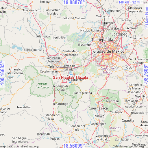
San Nicolás Tlazala GPS coordinates[2]
19° 13' 34.428" North, 99° 27' 49.392" West
| Map corner | latitude | longitude |
|---|---|---|
| Upper-left | 19.88878°, | -100.16685° |
| Center: | 19.22623°, | -99.46372° |
| Lower-right: | 18.56099°, | -98.7606° |
| Map W x H: | 147.6×147.6 km | = 91.7×91.7mi |
| max Lat: | 32.7° ⇑60.5% North |
| San Nicolás Tlazala: | 19.22623° |
| min Lat: | ⇓39.5% South 14.53588° |
| min Long | San Nicolás Tl | max Long |
| -117.105° | -99.46372° | -86.73105° |
| W 43.6%⇐ | ⇒56.4% E |
Elevation
Elevation of San Nicolás Tlazala is 2591 m = 8501 ft, and this is 1337.3 m = 4387 ft above average elevation for this country.
| Max E: |
3497 m = 11473 ft | 5.2% |
| San Nicolás Tlazala | 2591 m 8501 ft | |
| Avg. | 1253.7 m = 4113 ft | |
Min E: |
-1 m = -3 ft | 94.8% |
See also: Mexico elevation on elevation.city.
Geographical zone
San Nicolás Tlazala is located in North Torrid zone (between Equator and Tropic of Cancer). Distance of this Northern Tropic circle is 468.2 km =290.9 mi to North.| Distance of | km | miles | from San Nicolás Tlazala |
|---|---|---|---|
| North Pole | 7869.3 | 4889.8 | to North |
| Arctic Circle | 5263.4 | 3270.5 | to North |
| Tropic Cancer | 468.2 | 290.9 | to North |
| Equator | 2137.8 | 1328.4 | to South |


Nearby cities:
15 places around San Nicolás Tlazala: (largest is in red/bold)
• Agua Blanca
1 km =0.6 mi,  228°
228°
• Capulhuac de Mirafuentes
3.6 km =2.2 mi,  183°
183°
• Coamilpa de Juárez
3.8 km =2.4 mi,  146°
146°
• Colonia el Pirame
1.8 km =1.1 mi,  332°
332°
• Colonia la Poza
3.4 km =2.1 mi,  208°
208°
• El Llano del Compromiso
3.6 km =2.2 mi, 332°
• El Pedregal de Guadalupe Hidalgo
3 km =1.9 mi,  357°
357°
• Guadalupe Victoria
4.3 km =2.7 mi,  80°
80°
• Loma Bonita
4.5 km =2.8 mi,  22°
22°
• Loma de los Esquiveles
4.5 km =2.8 mi, 17°
• Lomas de San Juan
1.9 km =1.2 mi, 178°
• San Juan Bautista
2.9 km =1.8 mi,  165°
165°
• San Miguel Almaya
2.9 km =1.8 mi,  127°
127°
• Santa Cruz Tultepec
0.8 km =0.5 mi,  276°
276°
• Texcalpa (Ex-Hacienda Texcalpa)
3.9 km =2.4 mi,  11°
11°
Sources, notices
• [Note1] Compared only with cities in Mexico existing in our database
• [Src1] Map data: © OpenStreetMap contributors (CC-BY-SA)
• [Src2] Other city data from geonames.org with taken over terms of usage.
• [Src3] Geographical zone / Annual Mean Temperature by Robert A. Rohde @ Wikipedia
