Villa Jiménez geodata
Villa Jiménez (Michoacán) is a populated place; located in Mexico in America/Mexico_City (GMT-6) time zone. With population of 4,249 people, there are 2159 cities with bigger population in this country. Compared to other cities in Mexico, 55.5% of cities are located further ↓South; 79.4% of cities are located further →East and 74% of cities have lower elevation than Villa Jiménez. Note1


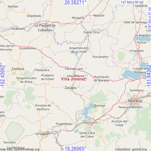
Villa Jiménez GPS coordinates[2]
19° 55' 23.016" North, 101° 44' 48.984" West
| Map corner | latitude | longitude |
|---|---|---|
| Upper-left | 20.58271°, | -102.45007° |
| Center: | 19.92306°, | -101.74694° |
| Lower-right: | 19.26065°, | -101.04382° |
| Map W x H: | 147×147 km | = 91.3×91.3mi |
| max Lat: | 32.7° ⇑44.5% North |
| Villa Jiménez: | 19.92306° |
| min Lat: | ⇓55.5% South 14.53588° |
| min Long | Villa Jiménez | max Long |
| -117.105° | -101.74694° | -86.73105° |
| W 20.6%⇐ | ⇒79.4% E |
Elevation
Elevation of Villa Jiménez is 2011 m = 6598 ft, and this is 757.3 m = 2485 ft above average elevation for this country.
| Max E: |
3497 m = 11473 ft | 26% |
| Villa Jiménez | 2011 m 6598 ft | |
| Avg. | 1253.7 m = 4113 ft | |
Min E: |
-1 m = -3 ft | 74% |
See also: Mexico elevation on elevation.city.
Geographical zone
Villa Jiménez is located in North Torrid zone (between Equator and Tropic of Cancer). Distance of this Northern Tropic circle is 390.7 km =242.8 mi to North.| Distance of | km | miles | from Villa Jiménez |
|---|---|---|---|
| North Pole | 7791.8 | 4841.6 | to North |
| Arctic Circle | 5185.9 | 3222.4 | to North |
| Tropic Cancer | 390.7 | 242.8 | to North |
| Equator | 2215.2 | 1376.5 | to South |


Nearby cities:
15 places around Villa Jiménez: (largest is in red/bold)
• Cantabria
9.5 km =5.9 mi,  166°
166°
• Caurio de la Rinconada
10.7 km =6.6 mi,  267°
267°
• Copándaro (Copándaro del Cuatro)
9.5 km =5.9 mi,  105°
105°
• El Fresno de la Reforma
4.3 km =2.7 mi,  334°
334°
• J. Trinidad Regalado (La Colonia)
11.8 km =7.3 mi,  358°
358°
• La Escondida
5.2 km =3.2 mi,  213°
213°
• La Luz
11.6 km =7.2 mi,  56°
56°
• La Vírgen
5 km =3.1 mi, 206°
• Las Colonias
3.1 km =1.9 mi, 113°
• Los Espinos
3.9 km =2.4 mi,  230°
230°
• Panindícuaro
7.1 km =4.4 mi,  348°
348°
• San Antonio Tariácuri
4.5 km =2.8 mi,  180°
180°
• Santa Gertrúdis
5.8 km =3.6 mi, 208°
• Urequío
8.6 km =5.3 mi,  45°
45°
• Zipimeo
2 km =1.2 mi,  276°
276°
Sources, notices
• [Note1] Compared only with cities in Mexico existing in our database
• [Src1] Map data: © OpenStreetMap contributors (CC-BY-SA)
• [Src2] Other city data from geonames.org with taken over terms of usage.
• [Src3] Geographical zone / Annual Mean Temperature by Robert A. Rohde @ Wikipedia
