Copándaro (Copándaro del Cuatro) geodata
Copándaro (Copándaro del Cuatro) (Michoacán) is a populated place; located in Mexico in America/Mexico_City (GMT-6) time zone. With population of 1,479 people, there are 5833 cities with bigger population in this country. Compared to other cities in Mexico, 55.1% of cities are located further ↓South; 78.7% of cities are located further →East and 73.1% of cities have lower elevation than Copándaro (Copándaro del Cuatro). Note1
Current local time in Copándaro (Copándaro del Cuatro):
08:44 AM, WednesdayDifference from your time zone: hours


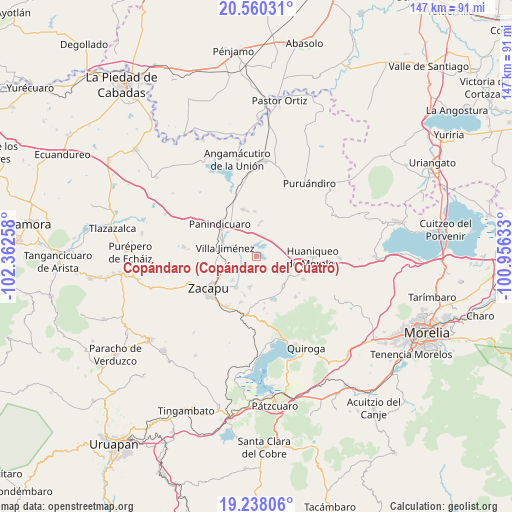
Copándaro (Copándaro del Cuatro) GPS coordinates[2]
19° 54' 2.052" North, 101° 39' 34.02" West
| Map corner | latitude | longitude |
|---|---|---|
| Upper-left | 20.56031°, | -102.36258° |
| Center: | 19.90057°, | -101.65945° |
| Lower-right: | 19.23806°, | -100.95633° |
| Map W x H: | 147×147 km | = 91.3×91.3mi |
| max Lat: | 32.7° ⇑44.9% North |
| Copándaro (Copándaro del Cuatro): | 19.90057° |
| min Lat: | ⇓55.1% South 14.53588° |
| min Long | Copándaro (Cop | max Long |
| -117.105° | -101.65945° | -86.73105° |
| W 21.3%⇐ | ⇒78.7% E |
Elevation
Elevation of Copándaro (Copándaro del Cuatro) is 1991 m = 6532 ft, and this is 737.3 m = 2419 ft above average elevation for this country.
| Max E: |
3497 m = 11473 ft | 26.9% |
| Copándaro (Copándaro del Cuatro) | 1991 m 6532 ft | |
| Avg. | 1253.7 m = 4113 ft | |
Min E: |
-1 m = -3 ft | 73.1% |
See also: Mexico elevation on elevation.city.
Geographical zone
Copándaro (Copándaro del Cuatro) is located in North Torrid zone (between Equator and Tropic of Cancer). Distance of this Northern Tropic circle is 393.2 km =244.3 mi to North.| Distance of | km | miles | from Copándaro (Copándaro del Cuatro) |
|---|---|---|---|
| North Pole | 7794.3 | 4843.2 | to North |
| Arctic Circle | 5188.4 | 3223.9 | to North |
| Tropic Cancer | 393.2 | 244.3 | to North |
| Equator | 2212.7 | 1374.9 | to South |


Nearby cities:
15 places around Copándaro (Copándaro del Cuatro): (largest is in red/bold)
• Bellas Fuentes
9.1 km =5.7 mi,  193°
193°
• Cantabria
9.7 km =6 mi,  226°
226°
• Coeneo de la Libertad
11.7 km =7.3 mi,  138°
138°
• Cortijo Viejo
11.9 km =7.4 mi,  197°
197°
• La Luz
8.9 km =5.5 mi,  3°
3°
• La Vírgen
11.6 km =7.2 mi,  260°
260°
• Las Colonias
6.4 km =4 mi,  281°
281°
• Los Espinos
12.1 km =7.5 mi,  270°
270°
• San Antonio Tariácuri
9.4 km =5.8 mi, 257°
• San Isidro
11.1 km =6.9 mi,  120°
120°
• San Lorenzo
10 km =6.2 mi,  8°
8°
• Tarejero
10.8 km =6.7 mi,  213°
213°
• Urequío
9.1 km =5.7 mi,  340°
340°
• Villa Jiménez
9.5 km =5.9 mi,  285°
285°
• Zipimeo
11.5 km =7.1 mi, 283°
Sources, notices
• [Note1] Compared only with cities in Mexico existing in our database
• [Src1] Map data: © OpenStreetMap contributors (CC-BY-SA)
• [Src2] Other city data from geonames.org with taken over terms of usage.
• [Src3] Geographical zone / Annual Mean Temperature by Robert A. Rohde @ Wikipedia
