San Nicolás Zecalacoayan geodata
San Nicolás Zecalacoayan (Puebla) is a populated place; located in Mexico in America/Mexico_City (GMT-6) time zone. With population of 2,575 people, there are 3441 cities with bigger population in this country. Compared to other cities in Mexico, 61.3% of cities are located further ↑North; 57.4% of cities are located further ←West and 91.7% of cities have lower elevation than San Nicolás Zecalacoayan. Note1
Current local time in San Nicolás Zecalacoayan:
12:35 PM, MondayDifference from your time zone: hours


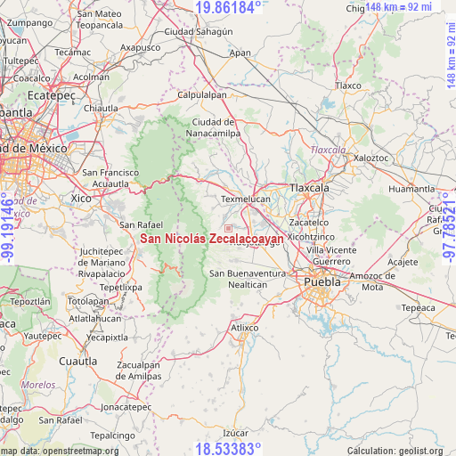
San Nicolás Zecalacoayan GPS coordinates[2]
19° 11' 57.012" North, 98° 29' 17.988" West
| Map corner | latitude | longitude |
|---|---|---|
| Upper-left | 19.86184°, | -99.19146° |
| Center: | 19.19917°, | -98.48833° |
| Lower-right: | 18.53383°, | -97.78521° |
| Map W x H: | 147.7×147.7 km | = 91.8×91.8mi |
| max Lat: | 32.7° ⇑61.3% North |
| San Nicolás Zecalacoayan: | 19.19917° |
| min Lat: | ⇓38.7% South 14.53588° |
| min Long | San Nicolás Ze | max Long |
| -117.105° | -98.48833° | -86.73105° |
| W 57.4%⇐ | ⇒42.6% E |
Elevation
Elevation of San Nicolás Zecalacoayan is 2469 m = 8100 ft, and this is 1215.3 m = 3987 ft above average elevation for this country.
| Max E: |
3497 m = 11473 ft | 8.3% |
| San Nicolás Zecalacoayan | 2469 m 8100 ft | |
| Avg. | 1253.7 m = 4113 ft | |
Min E: |
-1 m = -3 ft | 91.7% |
See also: Mexico elevation on elevation.city.
Geographical zone
San Nicolás Zecalacoayan is located in North Torrid zone (between Equator and Tropic of Cancer). Distance of this Northern Tropic circle is 471.2 km =292.8 mi to North.| Distance of | km | miles | from San Nicolás Zecalacoayan |
|---|---|---|---|
| North Pole | 7872.3 | 4891.6 | to North |
| Arctic Circle | 5266.4 | 3272.4 | to North |
| Tropic Cancer | 471.2 | 292.8 | to North |
| Equator | 2134.7 | 1326.4 | to South |


Nearby cities:
15 places around San Nicolás Zecalacoayan: (largest is in red/bold)
• San Agustín Atzompa
2.7 km =1.7 mi,  276°
276°
• San Antonio Tlatenco
3.1 km =1.9 mi,  203°
203°
• San Buenaventura Tecaltzingo
6.1 km =3.8 mi,  28°
28°
• San Gregorio Aztotoacan
7.3 km =4.5 mi,  357°
357°
• San Juan Pancoac
7.4 km =4.6 mi,  138°
138°
• San Juan Tetla
2.5 km =1.6 mi,  316°
316°
• San Lorenzo Chiautzingo
2.3 km =1.4 mi,  75°
75°
• San Luis Coyotzingo
5.4 km =3.4 mi,  91°
91°
• San Matías Atzala
5.8 km =3.6 mi,  6°
6°
• San Miguel Tianguizolco
6.7 km =4.2 mi,  132°
132°
• San Simón Atzitzintla
7.3 km =4.5 mi, 10°
• Santa María Atexcac
7.1 km =4.4 mi,  187°
187°
• Santa María Nepopualco
5.4 km =3.4 mi,  183°
183°
• Santa María Tianguistenco
6.6 km =4.1 mi, 135°
• Teotlaltzingo
3.8 km =2.4 mi,  339°
339°
Sources, notices
• [Note1] Compared only with cities in Mexico existing in our database
• [Src1] Map data: © OpenStreetMap contributors (CC-BY-SA)
• [Src2] Other city data from geonames.org with taken over terms of usage.
• [Src3] Geographical zone / Annual Mean Temperature by Robert A. Rohde @ Wikipedia
