Cerro las Iguanas geodata
Cerro las Iguanas (Veracruz) is a populated place; located in Mexico in America/Mexico_City (GMT-6) time zone. With population of 1,844 people, there are 4710 cities with bigger population in this country. Compared to other cities in Mexico, 73.7% of cities are located further ↑North; 84% of cities are located further ←West and 74.1% of cities have higher elevation than Cerro las Iguanas. Note1


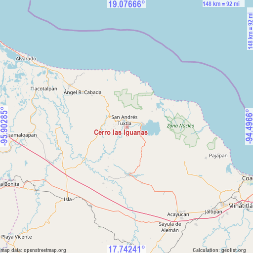
Cerro las Iguanas GPS coordinates[2]
18° 24' 38.988" North, 95° 11' 58.992" West
| Map corner | latitude | longitude |
|---|---|---|
| Upper-left | 19.07666°, | -95.90285° |
| Center: | 18.41083°, | -95.19972° |
| Lower-right: | 17.74241°, | -94.4966° |
| Map W x H: | 148.4×148.4 km | = 92.2×92.2mi |
| max Lat: | 32.7° ⇑73.7% North |
| Cerro las Iguanas: | 18.41083° |
| min Lat: | ⇓26.3% South 14.53588° |
| min Long | Cerro las Iguan | max Long |
| -117.105° | -95.19972° | -86.73105° |
| W 84%⇐ | ⇒16% E |
Elevation
Elevation of Cerro las Iguanas is 252 m = 827 ft, and this is 1001.7 m = 3286 ft below average elevation for this country.
| Max E: |
3497 m = 11473 ft | 74.1% |
| Avg. | 1253.7 m = 4113 ft | |
| Cerro las Iguanas | 252 m = 827 ft | |
Min E: |
-1 m = -3 ft | 25.9% |
See also: Mexico elevation on elevation.city.
Geographical zone
Cerro las Iguanas is located in North Torrid zone (between Equator and Tropic of Cancer). Distance of this Northern Tropic circle is 558.8 km =347.2 mi to North.| Distance of | km | miles | from Cerro las Iguanas |
|---|---|---|---|
| North Pole | 7960 | 4946.1 | to North |
| Arctic Circle | 5354.1 | 3326.9 | to North |
| Tropic Cancer | 558.8 | 347.2 | to North |
| Equator | 2047.1 | 1272 | to South |


Nearby cities:
15 places around Cerro las Iguanas: (largest is in red/bold)
• Bezuapan
4.5 km =2.8 mi,  91°
91°
• Calería
3.1 km =1.9 mi,  49°
49°
• Cebadilla Chica
5.3 km =3.3 mi,  152°
152°
• Cerro Amarillo de Abajo
5.5 km =3.4 mi,  278°
278°
• Cerro Amarillo de Arriba
4.8 km =3 mi,  288°
288°
• Comoapan
2.7 km =1.7 mi,  99°
99°
• El Huidero
3.4 km =2.1 mi,  140°
140°
• El Salto de Eyipantla
2.4 km =1.5 mi,  187°
187°
• José María Morelos y Pavón
2.6 km =1.6 mi,  274°
274°
• Los Pinos
5.9 km =3.7 mi,  308°
308°
• Matacapan
4.5 km =2.8 mi, 53°
• San Andrés Tuxtla
4.4 km =2.7 mi,  341°
341°
• Sihuapan
3.6 km =2.2 mi,  38°
38°
• Texalpan de Abajo
6.2 km =3.9 mi, 287°
• Texalpan de Arriba
5.1 km =3.2 mi, 293°
Sources, notices
• [Note1] Compared only with cities in Mexico existing in our database
• [Src1] Map data: © OpenStreetMap contributors (CC-BY-SA)
• [Src2] Other city data from geonames.org with taken over terms of usage.
• [Src3] Geographical zone / Annual Mean Temperature by Robert A. Rohde @ Wikipedia
