El Encanto geodata
El Encanto (Chiapas) is a populated place; located in Mexico in America/Mexico_City (GMT-6) time zone. With population of 1,726 people, there are 5029 cities with bigger population in this country. Compared to other cities in Mexico, 99.9% of cities are located further ↑North; 92.7% of cities are located further ←West and 98.1% of cities have higher elevation than El Encanto. Note1


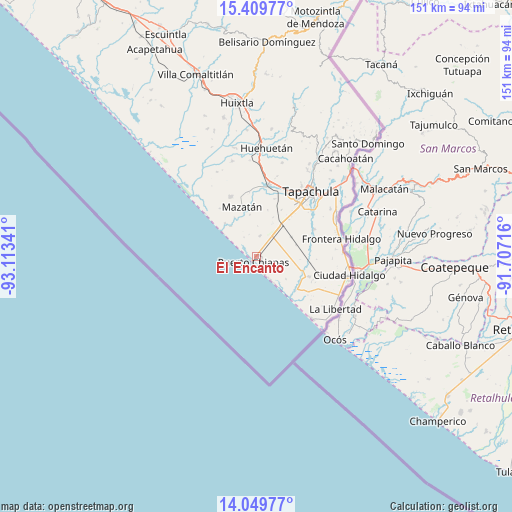
El Encanto GPS coordinates[2]
14° 43' 50.988" North, 92° 24' 37.008" West
| Map corner | latitude | longitude |
|---|---|---|
| Upper-left | 15.40977°, | -93.11341° |
| Center: | 14.73083°, | -92.41028° |
| Lower-right: | 14.04977°, | -91.70716° |
| Map W x H: | 151.2×151.2 km | = 94×94mi |
| max Lat: | 32.7° ⇑99.9% North |
| El Encanto: | 14.73083° |
| min Lat: | ⇓0.1% South 14.53588° |
| min Long | El Encanto | max Long |
| -117.105° | -92.41028° | -86.73105° |
| W 92.7%⇐ | ⇒7.3% E |
Elevation
Elevation of El Encanto is 8 m = 26 ft, and this is 1245.7 m = 4087 ft below average elevation for this country.
| Max E: |
3497 m = 11473 ft | 98.1% |
| Avg. | 1253.7 m = 4113 ft | |
| El Encanto | 8 m = 26 ft | |
Min E: |
-1 m = -3 ft | 1.9% |
See also: Mexico elevation on elevation.city.
Geographical zone
El Encanto is located in North Torrid zone (between Equator and Tropic of Cancer). Distance of this Northern Tropic circle is 968 km =601.5 mi to North.| Distance of | km | miles | from El Encanto |
|---|---|---|---|
| North Pole | 8369.1 | 5200.3 | to North |
| Arctic Circle | 5763.3 | 3581.1 | to North |
| Tropic Cancer | 968 | 601.5 | to North |
| Equator | 1637.9 | 1017.7 | to South |


Nearby cities:
15 places around El Encanto: (largest is in red/bold)
• Cebadilla 2da. Sección
14.9 km =9.3 mi,  48°
48°
• Congregación Reforma
11.8 km =7.3 mi,  61°
61°
• Cuatro Caminos
14.8 km =9.2 mi,  0°
0°
• Efraín A. Gutiérrez
11.8 km =7.3 mi,  319°
319°
• El Aguacate
12.5 km =7.8 mi,  351°
351°
• Francisco I. Madero (La Bolsa de la Botella)
14.1 km =8.8 mi,  13°
13°
• Guanacastal 1ra. Sección
13.2 km =8.2 mi,  331°
331°
• Joaquín Miguel Gutiérrez (El Manzano)
12.2 km =7.6 mi,  73°
73°
• La Victoria
13.5 km =8.4 mi, 316°
• Leoncillos
4.1 km =2.5 mi, 5°
• Mazatán
15.3 km =9.5 mi,  343°
343°
• Puerto Madero
1.6 km =1 mi,  227°
227°
• San Cristóbal Buenavista
8.6 km =5.3 mi,  25°
25°
• Tinajas 1ra. Sección
8.9 km =5.5 mi,  99°
99°
• Tinajas 3ra. Sección
7 km =4.3 mi, 54°
Sources, notices
• [Note1] Compared only with cities in Mexico existing in our database
• [Src1] Map data: © OpenStreetMap contributors (CC-BY-SA)
• [Src2] Other city data from geonames.org with taken over terms of usage.
• [Src3] Geographical zone / Annual Mean Temperature by Robert A. Rohde @ Wikipedia
