Santa Martha Hidalgo geodata
Santa Martha Hidalgo (Puebla) is a populated place; located in Mexico in America/Mexico_City (GMT-6) time zone. With population of 1,646 people, there are 5273 cities with bigger population in this country. Compared to other cities in Mexico, 65% of cities are located further ↑North; 59.6% of cities are located further ←West and 79.8% of cities have lower elevation than Santa Martha Hidalgo. Note1


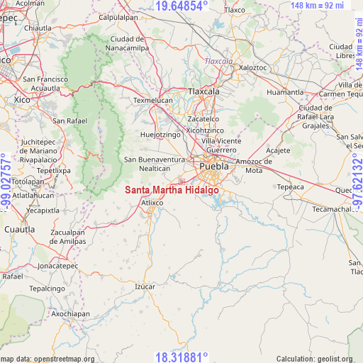
Santa Martha Hidalgo GPS coordinates[2]
18° 59' 6" North, 98° 19' 27.984" West
| Map corner | latitude | longitude |
|---|---|---|
| Upper-left | 19.64854°, | -99.02757° |
| Center: | 18.985°, | -98.32444° |
| Lower-right: | 18.31881°, | -97.62132° |
| Map W x H: | 147.9×147.9 km | = 91.9×91.9mi |
| max Lat: | 32.7° ⇑65% North |
| Santa Martha Hidalgo: | 18.985° |
| min Lat: | ⇓35% South 14.53588° |
| min Long | Santa Martha Hi | max Long |
| -117.105° | -98.32444° | -86.73105° |
| W 59.6%⇐ | ⇒40.4% E |
Elevation
Elevation of Santa Martha Hidalgo is 2135 m = 7005 ft, and this is 881.3 m = 2891 ft above average elevation for this country.
| Max E: |
3497 m = 11473 ft | 20.2% |
| Santa Martha Hidalgo | 2135 m 7005 ft | |
| Avg. | 1253.7 m = 4113 ft | |
Min E: |
-1 m = -3 ft | 79.8% |
See also: Mexico elevation on elevation.city.
Geographical zone
Santa Martha Hidalgo is located in North Torrid zone (between Equator and Tropic of Cancer). Distance of this Northern Tropic circle is 495 km =307.6 mi to North.| Distance of | km | miles | from Santa Martha Hidalgo |
|---|---|---|---|
| North Pole | 7896.1 | 4906.4 | to North |
| Arctic Circle | 5290.2 | 3287.2 | to North |
| Tropic Cancer | 495 | 307.6 | to North |
| Equator | 2110.9 | 1311.7 | to South |


Nearby cities:
15 places around Santa Martha Hidalgo: (largest is in red/bold)
• Chalchihuapan
2 km =1.2 mi,  222°
222°
• Chipilo de Francisco Javier Mina
2.4 km =1.5 mi,  344°
344°
• El Capulo (La Quebradora)
7.1 km =4.4 mi,  124°
124°
• Francisco Sarabia
2.6 km =1.6 mi,  154°
154°
• Los Reyes Tlanechicolpan
6 km =3.7 mi,  330°
330°
• San Bernabé Temoxtitla
1.5 km =0.9 mi, 333°
• San Bernardino Tlaxcalancingo
7 km =4.3 mi,  45°
45°
• San Gregorio Atzompa
5 km =3.1 mi, 329°
• San Isidro Petlácatl
3.3 km =2.1 mi,  130°
130°
• San Luis Tehuiloyocan
6.2 km =3.9 mi,  347°
347°
• San Pablo Ahuatempa
3.6 km =2.2 mi,  263°
263°
• Santa Ana Acozautla
7 km =4.3 mi,  242°
242°
• Santa Clara
2.6 km =1.6 mi,  112°
112°
• Santa Isabel Cholula
5.9 km =3.7 mi,  282°
282°
• Santa María Malacatepec
5.4 km =3.4 mi, 154°
Sources, notices
• [Note1] Compared only with cities in Mexico existing in our database
• [Src1] Map data: © OpenStreetMap contributors (CC-BY-SA)
• [Src2] Other city data from geonames.org with taken over terms of usage.
• [Src3] Geographical zone / Annual Mean Temperature by Robert A. Rohde @ Wikipedia
