Chalchihuapan geodata
Chalchihuapan (Puebla) is a populated place; located in Mexico in America/Mexico_City (GMT-6) time zone. With population of 5,061 people, there are 1830 cities with bigger population in this country. Compared to other cities in Mexico, 65.3% of cities are located further ↑North; 59.4% of cities are located further ←West and 83% of cities have lower elevation than Chalchihuapan. Note1


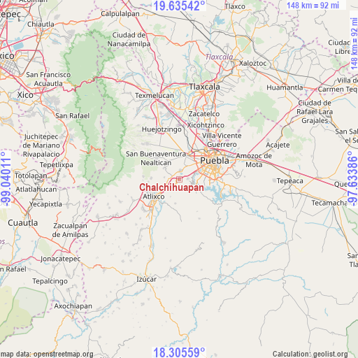
Chalchihuapan GPS coordinates[2]
18° 58' 18.588" North, 98° 20' 13.128" West
| Map corner | latitude | longitude |
|---|---|---|
| Upper-left | 19.63542°, | -99.04011° |
| Center: | 18.97183°, | -98.33698° |
| Lower-right: | 18.30559°, | -97.63386° |
| Map W x H: | 147.9×147.9 km | = 91.9×91.9mi |
| max Lat: | 32.7° ⇑65.3% North |
| Chalchihuapan: | 18.97183° |
| min Lat: | ⇓34.7% South 14.53588° |
| min Long | Chalchihuapan | max Long |
| -117.105° | -98.33698° | -86.73105° |
| W 59.4%⇐ | ⇒40.6% E |
Elevation
Elevation of Chalchihuapan is 2217 m = 7274 ft, and this is 963.3 m = 3160 ft above average elevation for this country.
| Max E: |
3497 m = 11473 ft | 17% |
| Chalchihuapan | 2217 m 7274 ft | |
| Avg. | 1253.7 m = 4113 ft | |
Min E: |
-1 m = -3 ft | 83% |
See also: Mexico elevation on elevation.city.
Geographical zone
Chalchihuapan is located in North Torrid zone (between Equator and Tropic of Cancer). Distance of this Northern Tropic circle is 496.4 km =308.4 mi to North.| Distance of | km | miles | from Chalchihuapan |
|---|---|---|---|
| North Pole | 7897.6 | 4907.3 | to North |
| Arctic Circle | 5291.7 | 3288.1 | to North |
| Tropic Cancer | 496.4 | 308.4 | to North |
| Equator | 2109.5 | 1310.8 | to South |


Nearby cities:
15 places around Chalchihuapan: (largest is in red/bold)
• Chipilo de Francisco Javier Mina
3.9 km =2.4 mi,  10°
10°
• Emiliano Zapata los Molinos
6.5 km =4 mi,  246°
246°
• Emilio Portes Gil
5.5 km =3.4 mi,  194°
194°
• Francisco Sarabia
2.6 km =1.6 mi,  109°
109°
• San Bernabé Temoxtitla
2.9 km =1.8 mi, 12°
• San Gregorio Atzompa
5.9 km =3.7 mi,  348°
348°
• San Isidro Petlácatl
3.9 km =2.4 mi,  100°
100°
• San Juan Portezuelo
6 km =3.7 mi,  200°
200°
• San Martín Tlamapa
6.3 km =3.9 mi,  275°
275°
• San Pablo Ahuatempa
2.5 km =1.6 mi,  294°
294°
• Santa Ana Acozautla
5.2 km =3.2 mi, 249°
• Santa Clara
3.8 km =2.4 mi,  82°
82°
• Santa Isabel Cholula
5.2 km =3.2 mi,  301°
301°
• Santa Martha Hidalgo
2 km =1.2 mi,  42°
42°
• Santa María Malacatepec
5 km =3.1 mi,  132°
132°
Sources, notices
• [Note1] Compared only with cities in Mexico existing in our database
• [Src1] Map data: © OpenStreetMap contributors (CC-BY-SA)
• [Src2] Other city data from geonames.org with taken over terms of usage.
• [Src3] Geographical zone / Annual Mean Temperature by Robert A. Rohde @ Wikipedia
