Chiquinshulum geodata
Chiquinshulum (Chiapas) is a populated place; located in Mexico in America/Mexico_City (GMT-6) time zone. With population of 1,612 people, there are 5372 cities with bigger population in this country. Compared to other cities in Mexico, 87.9% of cities are located further ↑North; 91.2% of cities are located further ←West and 59.7% of cities have higher elevation than Chiquinshulum. Note1


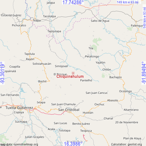
Chiquinshulum GPS coordinates[2]
17° 4' 18.984" North, 92° 35' 53.016" West
| Map corner | latitude | longitude |
|---|---|---|
| Upper-left | 17.74286°, | -93.30119° |
| Center: | 17.07194°, | -92.59806° |
| Lower-right: | 16.3986°, | -91.89494° |
| Map W x H: | 149.5×149.5 km | = 92.9×92.9mi |
| max Lat: | 32.7° ⇑87.9% North |
| Chiquinshulum: | 17.07194° |
| min Lat: | ⇓12.1% South 14.53588° |
| min Long | Chiquinshulum | max Long |
| -117.105° | -92.59806° | -86.73105° |
| W 91.2%⇐ | ⇒8.8% E |
Elevation
Elevation of Chiquinshulum is 1017 m = 3337 ft, and this is 236.7 m = 777 ft below average elevation for this country.
| Max E: |
3497 m = 11473 ft | 59.7% |
| Avg. | 1253.7 m = 4113 ft | |
| Chiquinshulum | 1017 m = 3337 ft | |
Min E: |
-1 m = -3 ft | 40.3% |
See also: Mexico elevation on elevation.city.
Geographical zone
Chiquinshulum is located in North Torrid zone (between Equator and Tropic of Cancer). Distance of this Northern Tropic circle is 707.7 km =439.7 mi to North.| Distance of | km | miles | from Chiquinshulum |
|---|---|---|---|
| North Pole | 8108.8 | 5038.6 | to North |
| Arctic Circle | 5503 | 3419.4 | to North |
| Tropic Cancer | 707.7 | 439.7 | to North |
| Equator | 1898.2 | 1179.5 | to South |


Nearby cities:
15 places around Chiquinshulum: (largest is in red/bold)
• Canolal
10.6 km =6.6 mi,  124°
124°
• Chabajebal
9.6 km =6 mi,  253°
253°
• Concepción el Amparo
2.7 km =1.7 mi,  282°
282°
• Constitución
7.9 km =4.9 mi,  87°
87°
• Cruztón
7.7 km =4.8 mi,  103°
103°
• El Jardín
10.5 km =6.5 mi,  359°
359°
• El Roblar Chishtontic
10.4 km =6.5 mi, 94°
• Jolitontic
5 km =3.1 mi,  238°
238°
• Joltealal
2.6 km =1.6 mi, 282°
• José Castillo Tielemans
10.9 km =6.8 mi,  42°
42°
• Las Mercedes Esperanza
6.5 km =4 mi, 44°
• Maravillas
8.4 km =5.2 mi,  30°
30°
• Natividad Pechuag
4.5 km =2.8 mi,  331°
331°
• Saclum
1.7 km =1.1 mi, 333°
• San Antonio Nuevo León
10.8 km =6.7 mi, 26°
Sources, notices
• [Note1] Compared only with cities in Mexico existing in our database
• [Src1] Map data: © OpenStreetMap contributors (CC-BY-SA)
• [Src2] Other city data from geonames.org with taken over terms of usage.
• [Src3] Geographical zone / Annual Mean Temperature by Robert A. Rohde @ Wikipedia
