Natividad Pechuag geodata
Natividad Pechuag (Chiapas) is a populated place; located in Mexico in America/Mexico_City (GMT-6) time zone. With population of 664 people, there are 13077 cities with bigger population in this country. Compared to other cities in Mexico, 87.6% of cities are located further ↑North; 91.1% of cities are located further ←West and 68.3% of cities have higher elevation than Natividad Pechuag. Note1


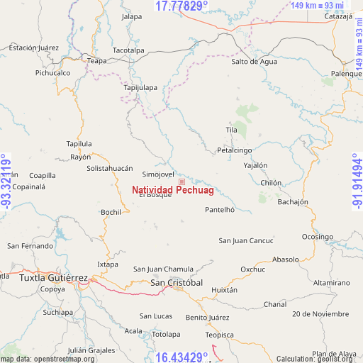
Natividad Pechuag GPS coordinates[2]
17° 6' 27" North, 92° 37' 5.016" West
| Map corner | latitude | longitude |
|---|---|---|
| Upper-left | 17.77829°, | -93.32119° |
| Center: | 17.1075°, | -92.61806° |
| Lower-right: | 16.43429°, | -91.91494° |
| Map W x H: | 149.4×149.4 km | = 92.8×92.8mi |
| max Lat: | 32.7° ⇑87.6% North |
| Natividad Pechuag: | 17.1075° |
| min Lat: | ⇓12.4% South 14.53588° |
| min Long | Natividad Pechu | max Long |
| -117.105° | -92.61806° | -86.73105° |
| W 91.1%⇐ | ⇒8.9% E |
Elevation
Elevation of Natividad Pechuag is 508 m = 1667 ft, and this is 745.7 m = 2447 ft below average elevation for this country.
| Max E: |
3497 m = 11473 ft | 68.3% |
| Avg. | 1253.7 m = 4113 ft | |
| Natividad Pechuag | 508 m = 1667 ft | |
Min E: |
-1 m = -3 ft | 31.7% |
See also: Mexico elevation on elevation.city.
Geographical zone
Natividad Pechuag is located in North Torrid zone (between Equator and Tropic of Cancer). Distance of this Northern Tropic circle is 703.7 km =437.3 mi to North.| Distance of | km | miles | from Natividad Pechuag |
|---|---|---|---|
| North Pole | 8104.9 | 5036.1 | to North |
| Arctic Circle | 5499 | 3416.9 | to North |
| Tropic Cancer | 703.7 | 437.3 | to North |
| Equator | 1902.2 | 1182 | to South |


Nearby cities:
15 places around Natividad Pechuag: (largest is in red/bold)
• Chabajebal
9.8 km =6.1 mi,  226°
226°
• Chiquinshulum
4.5 km =2.8 mi,  151°
151°
• Concepción el Amparo
3.4 km =2.1 mi,  189°
189°
• Constitución
10.6 km =6.6 mi,  109°
109°
• El Jardín
6.9 km =4.3 mi,  16°
16°
• Huitiupán
10.2 km =6.3 mi,  314°
314°
• Jolitontic
6.9 km =4.3 mi,  198°
198°
• Joltealal
3.4 km =2.1 mi, 186°
• José Castillo Tielemans
10.3 km =6.4 mi,  66°
66°
• Las Limas
8.7 km =5.4 mi,  262°
262°
• Las Mercedes Esperanza
6.7 km =4.2 mi,  84°
84°
• Maravillas
7.2 km =4.5 mi,  63°
63°
• Saclum
2.8 km =1.7 mi, 150°
• San Antonio Nuevo León
9 km =5.6 mi,  51°
51°
• Simojovel de Allende
10.8 km =6.7 mi,  289°
289°
Sources, notices
• [Note1] Compared only with cities in Mexico existing in our database
• [Src1] Map data: © OpenStreetMap contributors (CC-BY-SA)
• [Src2] Other city data from geonames.org with taken over terms of usage.
• [Src3] Geographical zone / Annual Mean Temperature by Robert A. Rohde @ Wikipedia
