El Palmar (San Gabriel) geodata
El Palmar (San Gabriel) (Chiapas) is a populated place; located in Mexico in America/Mexico_City (GMT-6) time zone. With population of 1,477 people, there are 5846 cities with bigger population in this country. Compared to other cities in Mexico, 91.1% of cities are located further ↑North; 88.5% of cities are located further ←West and 51.8% of cities have higher elevation than El Palmar (San Gabriel). Note1
Current local time in El Palmar (San Gabriel):
12:57 AM, WednesdayDifference from your time zone: hours


El Palmar (San Gabriel) GPS coordinates[2]
16° 50' 44.016" North, 93° 0' 59.004" West
| Map corner | latitude | longitude |
|---|---|---|
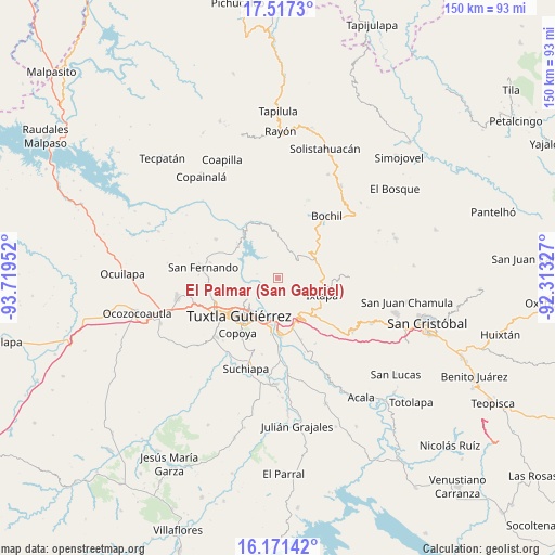
| Upper-left | 17.5173°, | -93.71952° |
| Center: | 16.84556°, | -93.01639° |
| Lower-right: | 16.17142°, | -92.31327° |
| Map W x H: | 149.6×149.7 km | = 93×93mi |
| max Lat: | 32.7° ⇑91.1% North |
| El Palmar (San Gabriel): | 16.84556° |
| min Lat: | ⇓8.9% South 14.53588° |
| min Long | El Palmar (San | max Long |
| -117.105° | -93.01639° | -86.73105° |
| W 88.5%⇐ | ⇒11.5% E |
Elevation
Elevation of El Palmar (San Gabriel) is 1348 m = 4423 ft, and this is 94.3 m = 309 ft above average elevation for this country.
| Max E: |
3497 m = 11473 ft | 51.8% |
| El Palmar (San Gabriel) | 1348 m 4423 ft | |
| Avg. | 1253.7 m = 4113 ft | |
Min E: |
-1 m = -3 ft | 48.2% |
See also: Mexico elevation on elevation.city.
Geographical zone
El Palmar (San Gabriel) is located in North Torrid zone (between Equator and Tropic of Cancer). Distance of this Northern Tropic circle is 732.9 km =455.4 mi to North.| Distance of | km | miles | from El Palmar (San Gabriel) |
|---|---|---|---|
| North Pole | 8134 | 5054.2 | to North |
| Arctic Circle | 5528.1 | 3435 | to North |
| Tropic Cancer | 732.9 | 455.4 | to North |
| Equator | 1873.1 | 1163.9 | to South |


Nearby cities:
15 places around El Palmar (San Gabriel): (largest is in red/bold)
• Concepción
6.8 km =4.2 mi,  126°
126°
• Cuauhtémoc
12.2 km =7.6 mi, 130°
• El Horizonte
7.2 km =4.5 mi,  57°
57°
• El Zapotillo
7 km =4.3 mi,  97°
97°
• Francisco Sarabia
11.2 km =7 mi,  1°
1°
• Ixtapa
12.7 km =7.9 mi,  111°
111°
• Libertad Campesina
4.1 km =2.5 mi,  334°
334°
• Miguel Hidalgo
5 km =3.1 mi,  94°
94°
• Modelo (El Zapotal)
9.5 km =5.9 mi, 94°
• Nuevo San Miguel Mitontic (Punta de Piedad)
9 km =5.6 mi,  124°
124°
• Osumacinta
12.8 km =8 mi,  322°
322°
• San Antonio Zaragoza
8.4 km =5.2 mi,  347°
347°
• Soyaló
11 km =6.8 mi, 62°
• Triunfo Agrarista
5.9 km =3.7 mi,  280°
280°
• Venustiano Carranza
5.8 km =3.6 mi,  12°
12°
Sources, notices
• [Note1] Compared only with cities in Mexico existing in our database
• [Src1] Map data: © OpenStreetMap contributors (CC-BY-SA)
• [Src2] Other city data from geonames.org with taken over terms of usage.
• [Src3] Geographical zone / Annual Mean Temperature by Robert A. Rohde @ Wikipedia
