Tlacoaxtla geodata
Tlacoaxtla (Guerrero) is a populated place; located in Mexico in America/Mexico_City (GMT-6) time zone. With population of 1,369 people, there are 6339 cities with bigger population in this country. Compared to other cities in Mexico, 82.5% of cities are located further ↑North; 52.8% of cities are located further →East and 54.8% of cities have lower elevation than Tlacoaxtla. Note1


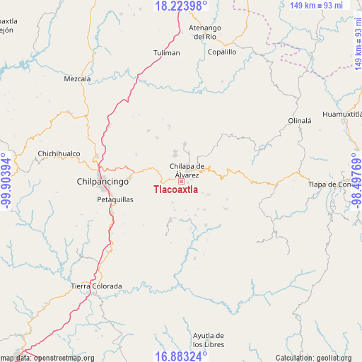
Tlacoaxtla GPS coordinates[2]
17° 33' 17.46" North, 99° 12' 2.916" West
| Map corner | latitude | longitude |
|---|---|---|
| Upper-left | 18.22398°, | -99.90394° |
| Center: | 17.55485°, | -99.20081° |
| Lower-right: | 16.88324°, | -98.49769° |
| Map W x H: | 149.1×149.1 km | = 92.6×92.6mi |
| max Lat: | 32.7° ⇑82.5% North |
| Tlacoaxtla: | 17.55485° |
| min Lat: | ⇓17.5% South 14.53588° |
| min Long | Tlacoaxtla | max Long |
| -117.105° | -99.20081° | -86.73105° |
| W 47.2%⇐ | ⇒52.8% E |
Elevation
Elevation of Tlacoaxtla is 1583 m = 5194 ft, and this is 329.3 m = 1080 ft above average elevation for this country.
| Max E: |
3497 m = 11473 ft | 45.2% |
| Tlacoaxtla | 1583 m 5194 ft | |
| Avg. | 1253.7 m = 4113 ft | |
Min E: |
-1 m = -3 ft | 54.8% |
See also: Mexico elevation on elevation.city.
Geographical zone
Tlacoaxtla is located in North Torrid zone (between Equator and Tropic of Cancer). Distance of this Northern Tropic circle is 654 km =406.4 mi to North.| Distance of | km | miles | from Tlacoaxtla |
|---|---|---|---|
| North Pole | 8055.1 | 5005.2 | to North |
| Arctic Circle | 5449.3 | 3386 | to North |
| Tropic Cancer | 654 | 406.4 | to North |
| Equator | 1951.9 | 1212.9 | to South |


Nearby cities:
15 places around Tlacoaxtla: (largest is in red/bold)
• Ahuexotitlán
5.4 km =3.4 mi,  237°
237°
• Amate Amarillo
3.6 km =2.2 mi,  353°
353°
• Axopilco
3.1 km =1.9 mi,  183°
183°
• Coaquimixco
4.6 km =2.9 mi,  306°
306°
• Cuadrilla Nueva
2.9 km =1.8 mi,  328°
328°
• Cuauhtenango
1.1 km =0.7 mi,  213°
213°
• Los Amates
1.3 km =0.8 mi,  138°
138°
• Macuixcatlán
4.5 km =2.8 mi,  81°
81°
• Ocuituco (Acuituco)
1.7 km =1.1 mi,  57°
57°
• Santa Ana
3.1 km =1.9 mi, 314°
• Santa Catarina
2.8 km =1.7 mi,  104°
104°
• Tlaxinga (Clatzinga)
3.8 km =2.4 mi,  168°
168°
• Xochitempa
4.5 km =2.8 mi,  132°
132°
• Zinantla
3 km =1.9 mi,  152°
152°
• Zoquitipa
2.7 km =1.7 mi, 135°
Sources, notices
• [Note1] Compared only with cities in Mexico existing in our database
• [Src1] Map data: © OpenStreetMap contributors (CC-BY-SA)
• [Src2] Other city data from geonames.org with taken over terms of usage.
• [Src3] Geographical zone / Annual Mean Temperature by Robert A. Rohde @ Wikipedia
