Álvaro Obregón (Santa Cruz) geodata
Álvaro Obregón (Santa Cruz) (Tabasco) is a populated place; located in Mexico in America/Mexico_City (GMT-6) time zone. With population of 1,304 people, there are 6654 cities with bigger population in this country. Compared to other cities in Mexico, 73.9% of cities are located further ↑North; 89.8% of cities are located further ←West and 99.6% of cities have higher elevation than Álvaro Obregón (Santa Cruz). Note1
Current local time in Álvaro Obregón (Santa Cruz):
08:32 AM, WednesdayDifference from your time zone: hours


Álvaro Obregón (Santa Cruz) GPS coordinates[2]
18° 23' 39.192" North, 92° 47' 59.352" West
| Map corner | latitude | longitude |
|---|---|---|
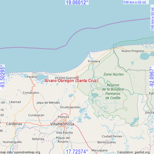
| Upper-left | 19.06012°, | -93.50295° |
| Center: | 18.39422°, | -92.79982° |
| Lower-right: | 17.72574°, | -92.0967° |
| Map W x H: | 148.4×148.4 km | = 92.2×92.2mi |
| max Lat: | 32.7° ⇑73.9% North |
| Álvaro Obregón (Santa Cruz): | 18.39422° |
| min Lat: | ⇓26.1% South 14.53588° |
| min Long | Álvaro Obregó | max Long |
| -117.105° | -92.79982° | -86.73105° |
| W 89.8%⇐ | ⇒10.2% E |
Elevation
Elevation of Álvaro Obregón (Santa Cruz) is 4 m = 13 ft, and this is 1249.7 m = 4100 ft below average elevation for this country.
| Max E: |
3497 m = 11473 ft | 99.6% |
| Avg. | 1253.7 m = 4113 ft | |
| Álvaro Obregón (Santa Cruz) | 4 m = 13 ft | |
Min E: |
-1 m = -3 ft | 0.4% |
See also: Mexico elevation on elevation.city.
Geographical zone
Álvaro Obregón (Santa Cruz) is located in North Torrid zone (between Equator and Tropic of Cancer). Distance of this Northern Tropic circle is 560.7 km =348.4 mi to North.| Distance of | km | miles | from Álvaro Obregón (Santa Cruz) |
|---|---|---|---|
| North Pole | 7961.8 | 4947.2 | to North |
| Arctic Circle | 5355.9 | 3328 | to North |
| Tropic Cancer | 560.7 | 348.4 | to North |
| Equator | 2045.2 | 1270.8 | to South |


Nearby cities:
15 places around Álvaro Obregón (Santa Cruz): (largest is in red/bold)
• Benito Juárez
3.5 km =2.2 mi,  354°
354°
• Caparroso
5.5 km =3.4 mi,  184°
184°
• Constancia y Venecia
5.2 km =3.2 mi,  331°
331°
• Ejido Benito Juárez
6.6 km =4.1 mi,  342°
342°
• Francisco Villa
8.5 km =5.3 mi,  277°
277°
• Frontera
3.9 km =2.4 mi,  311°
311°
• Gobernador Cruz
8.8 km =5.5 mi,  299°
299°
• Gregorio Méndez Magaña
9.4 km =5.8 mi, 284°
• Ignacio Allende
4.8 km =3 mi,  255°
255°
• José María Morelos y Pavón
5.7 km =3.5 mi,  294°
294°
• La Unión
8.9 km =5.5 mi, 282°
• Potrerillo
6.4 km =4 mi,  219°
219°
• San José del Carmen
3.2 km =2 mi,  21°
21°
• Simón Sarlat
5.6 km =3.5 mi,  188°
188°
• Álvaro Obregón 2da. Sección (El Lechugal)
0.9 km =0.6 mi,  99°
99°
Sources, notices
• [Note1] Compared only with cities in Mexico existing in our database
• [Src1] Map data: © OpenStreetMap contributors (CC-BY-SA)
• [Src2] Other city data from geonames.org with taken over terms of usage.
• [Src3] Geographical zone / Annual Mean Temperature by Robert A. Rohde @ Wikipedia
