Chichicapa geodata
Chichicapa (Puebla) is a populated place; located in Mexico in America/Mexico_City (GMT-6) time zone. With population of 1,183 people, there are 7346 cities with bigger population in this country. Compared to other cities in Mexico, 73.8% of cities are located further ↑North; 74.2% of cities are located further ←West and 92.5% of cities have lower elevation than Chichicapa. Note1


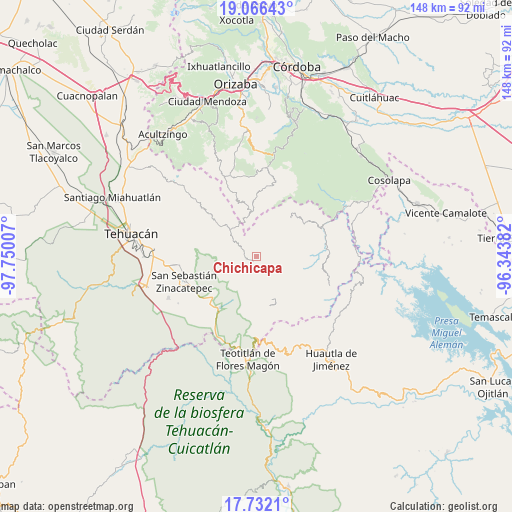
Chichicapa GPS coordinates[2]
18° 24' 2.016" North, 97° 2' 48.984" West
| Map corner | latitude | longitude |
|---|---|---|
| Upper-left | 19.06643°, | -97.75007° |
| Center: | 18.40056°, | -97.04694° |
| Lower-right: | 17.7321°, | -96.34382° |
| Map W x H: | 148.4×148.4 km | = 92.2×92.2mi |
| max Lat: | 32.7° ⇑73.8% North |
| Chichicapa: | 18.40056° |
| min Lat: | ⇓26.2% South 14.53588° |
| min Long | Chichicapa | max Long |
| -117.105° | -97.04694° | -86.73105° |
| W 74.2%⇐ | ⇒25.8% E |
Elevation
Elevation of Chichicapa is 2505 m = 8219 ft, and this is 1251.3 m = 4105 ft above average elevation for this country.
| Max E: |
3497 m = 11473 ft | 7.5% |
| Chichicapa | 2505 m 8219 ft | |
| Avg. | 1253.7 m = 4113 ft | |
Min E: |
-1 m = -3 ft | 92.5% |
See also: Mexico elevation on elevation.city.
Geographical zone
Chichicapa is located in North Torrid zone (between Equator and Tropic of Cancer). Distance of this Northern Tropic circle is 560 km =348 mi to North.| Distance of | km | miles | from Chichicapa |
|---|---|---|---|
| North Pole | 7961.1 | 4946.8 | to North |
| Arctic Circle | 5355.2 | 3327.6 | to North |
| Tropic Cancer | 560 | 348 | to North |
| Equator | 2046 | 1271.3 | to South |


Nearby cities:
15 places around Chichicapa: (largest is in red/bold)
• Acatepec
3.3 km =2.1 mi,  160°
160°
• Boca del Monte
3.6 km =2.2 mi,  250°
250°
• Cinco Señores
4.7 km =2.9 mi,  225°
225°
• Coxolico
5.9 km =3.7 mi,  17°
17°
• Cuabcapula
3.2 km =2 mi,  61°
61°
• Loma Bonita
1.8 km =1.1 mi, 57°
• Mazatianquixco
5.2 km =3.2 mi,  320°
320°
• Mexcaltochintla
2.3 km =1.4 mi,  3°
3°
• Moyotepec
6.7 km =4.2 mi, 323°
• Rancho Nuevo
6.7 km =4.2 mi,  348°
348°
• San Sebastián Alcomunga
4.6 km =2.9 mi,  27°
27°
• Tepetlampa
2.7 km =1.7 mi,  335°
335°
• Vista Hermosa Zayulapa
6.4 km =4 mi,  302°
302°
• Zacatlamanic
3.8 km =2.4 mi,  6°
6°
• Ízhuapa
3.6 km =2.2 mi,  121°
121°
Sources, notices
• [Note1] Compared only with cities in Mexico existing in our database
• [Src1] Map data: © OpenStreetMap contributors (CC-BY-SA)
• [Src2] Other city data from geonames.org with taken over terms of usage.
• [Src3] Geographical zone / Annual Mean Temperature by Robert A. Rohde @ Wikipedia
