Progreso (Campo 47) geodata
Progreso (Campo 47) (Sonora) is a populated place; located in Mexico in America/Hermosillo (GMT-7) time zone. With population of 1,170 people, there are 7425 cities with bigger population in this country. Compared to other cities in Mexico, 96.7% of cities are located further ↓South; 98.2% of cities are located further →East and 93.5% of cities have higher elevation than Progreso (Campo 47). Note1


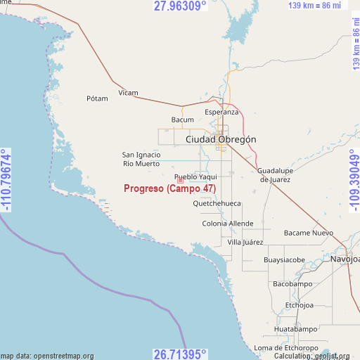
Progreso (Campo 47) GPS coordinates[2]
27° 20' 25.008" North, 110° 5' 36.996" West
| Map corner | latitude | longitude |
|---|---|---|
| Upper-left | 27.96309°, | -110.79674° |
| Center: | 27.34028°, | -110.09361° |
| Lower-right: | 26.71395°, | -109.39049° |
| Map W x H: | 138.9×138.9 km | = 86.3×86.3mi |
| max Lat: | 32.7° ⇑3.3% North |
| Progreso (Campo 47): | 27.34028° |
| min Lat: | ⇓96.7% South 14.53588° |
| min Long | Progreso (Campo | max Long |
| -117.105° | -110.09361° | -86.73105° |
| W 1.8%⇐ | ⇒98.2% E |
Elevation
Elevation of Progreso (Campo 47) is 16 m = 52 ft, and this is 1237.7 m = 4061 ft below average elevation for this country.
| Max E: |
3497 m = 11473 ft | 93.5% |
| Avg. | 1253.7 m = 4113 ft | |
| Progreso (Campo 47) | 16 m = 52 ft | |
Min E: |
-1 m = -3 ft | 6.5% |
See also: Mexico elevation on elevation.city.
Geographical zone
Progreso (Campo 47) is located in North temperate zone (between Tropic of Cancer and the Arctic Circle). Distance of this Northern Tropic circle is 434 km =269.7 mi to South.| Distance of | km | miles | from Progreso (Campo 47) |
|---|---|---|---|
| North Pole | 6967.1 | 4329.2 | to North |
| Arctic Circle | 4361.2 | 2709.9 | to North |
| Tropic Cancer | 434 | 269.7 | to South |
| Equator | 3040 | 1889 | to South |


Nearby cities:
15 places around Progreso (Campo 47): (largest is in red/bold)
• 31 de Octubre
7.4 km =4.6 mi,  131°
131°
• Atotonilco
8.6 km =5.3 mi,  244°
244°
• Campo Sesenta
12.2 km =7.6 mi,  357°
357°
• Cuauhtémoc (Campo Cinco)
12.8 km =8 mi,  36°
36°
• Ejido Tepeyac (Campo Dos)
17.4 km =10.8 mi,  25°
25°
• El Tobarito
20 km =12.4 mi,  80°
80°
• Francisco Javier Mina
13.6 km =8.5 mi,  353°
353°
• Marte R. Gómez (Tobarito)
20.7 km =12.9 mi, 81°
• Mora Villalobos
19.4 km =12.1 mi,  11°
11°
• Morelos Uno
11.8 km =7.3 mi, 125°
• Primero de Mayo
6 km =3.7 mi,  332°
332°
• Pueblo Yaqui
6.1 km =3.8 mi,  74°
74°
• Quetchehueca
16.6 km =10.3 mi,  120°
120°
• San Ignacio Río Muerto
17.3 km =10.7 mi,  299°
299°
• San José de Bacum
20 km =12.4 mi, 345°
Sources, notices
• [Note1] Compared only with cities in Mexico existing in our database
• [Src1] Map data: © OpenStreetMap contributors (CC-BY-SA)
• [Src2] Other city data from geonames.org with taken over terms of usage.
• [Src3] Geographical zone / Annual Mean Temperature by Robert A. Rohde @ Wikipedia
