Morelos Uno geodata
Morelos Uno (Sonora) is a populated place; located in Mexico in America/Hermosillo (GMT-7) time zone. With population of 788 people, there are 11082 cities with bigger population in this country. Compared to other cities in Mexico, 96.7% of cities are located further ↓South; 98.2% of cities are located further →East and 92.1% of cities have higher elevation than Morelos Uno. Note1


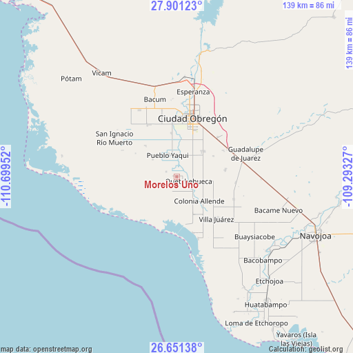
Morelos Uno GPS coordinates[2]
27° 16' 41.016" North, 109° 59' 47.004" West
| Map corner | latitude | longitude |
|---|---|---|
| Upper-left | 27.90123°, | -110.69952° |
| Center: | 27.27806°, | -109.99639° |
| Lower-right: | 26.65138°, | -109.29327° |
| Map W x H: | 139×139 km | = 86.4×86.4mi |
| max Lat: | 32.7° ⇑3.3% North |
| Morelos Uno: | 27.27806° |
| min Lat: | ⇓96.7% South 14.53588° |
| min Long | Morelos Uno | max Long |
| -117.105° | -109.99639° | -86.73105° |
| W 1.8%⇐ | ⇒98.2% E |
Elevation
Elevation of Morelos Uno is 19 m = 62 ft, and this is 1234.7 m = 4051 ft below average elevation for this country.
| Max E: |
3497 m = 11473 ft | 92.1% |
| Avg. | 1253.7 m = 4113 ft | |
| Morelos Uno | 19 m = 62 ft | |
Min E: |
-1 m = -3 ft | 7.9% |
See also: Mexico elevation on elevation.city.
Geographical zone
Morelos Uno is located in North temperate zone (between Tropic of Cancer and the Arctic Circle). Distance of this Northern Tropic circle is 427.1 km =265.4 mi to South.| Distance of | km | miles | from Morelos Uno |
|---|---|---|---|
| North Pole | 6974 | 4333.4 | to North |
| Arctic Circle | 4368.1 | 2714.2 | to North |
| Tropic Cancer | 427.1 | 265.4 | to South |
| Equator | 3033 | 1884.6 | to South |


Nearby cities:
15 places around Morelos Uno: (largest is in red/bold)
• 31 de Octubre
4.5 km =2.8 mi,  295°
295°
• Allende
13 km =8.1 mi,  137°
137°
• Altos de Jecopaco
15.7 km =9.8 mi, 139°
• Antonio Rosales
16.3 km =10.1 mi,  60°
60°
• Atotonilco
17.7 km =11 mi,  280°
280°
• Campo Sesenta
21.7 km =13.5 mi,  331°
331°
• Cuauhtémoc (Campo Cinco)
17.4 km =10.8 mi,  353°
353°
• El Tobarito
14.4 km =8.9 mi,  44°
44°
• Francisco Villa
21.1 km =13.1 mi, 61°
• Marte R. Gómez (Tobarito)
14.8 km =9.2 mi,  47°
47°
• Primero de Mayo
17.4 km =10.8 mi,  314°
314°
• Progreso (Campo 47)
11.8 km =7.3 mi, 305°
• Pueblo Yaqui
9.4 km =5.8 mi,  336°
336°
• Quetchehueca
4.9 km =3 mi,  108°
108°
• Santa María del Buáraje
19.3 km =12 mi,  82°
82°
Sources, notices
• [Note1] Compared only with cities in Mexico existing in our database
• [Src1] Map data: © OpenStreetMap contributors (CC-BY-SA)
• [Src2] Other city data from geonames.org with taken over terms of usage.
• [Src3] Geographical zone / Annual Mean Temperature by Robert A. Rohde @ Wikipedia
