Pechucalco geodata
Pechucalco (Tabasco) is a populated place; located in Mexico in America/Mexico_City (GMT-6) time zone. With population of 1,139 people, there are 7626 cities with bigger population in this country. Compared to other cities in Mexico, 77.6% of cities are located further ↑North; 87.7% of cities are located further ←West and 93.5% of cities have higher elevation than Pechucalco. Note1


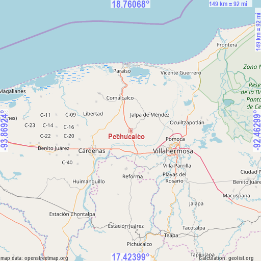
Pechucalco GPS coordinates[2]
18° 5' 36.996" North, 93° 9' 57.996" West
| Map corner | latitude | longitude |
|---|---|---|
| Upper-left | 18.76068°, | -93.86924° |
| Center: | 18.09361°, | -93.16611° |
| Lower-right: | 17.42399°, | -92.46299° |
| Map W x H: | 148.6×148.6 km | = 92.3×92.3mi |
| max Lat: | 32.7° ⇑77.6% North |
| Pechucalco: | 18.09361° |
| min Lat: | ⇓22.4% South 14.53588° |
| min Long | Pechucalco | max Long |
| -117.105° | -93.16611° | -86.73105° |
| W 87.7%⇐ | ⇒12.3% E |
Elevation
Elevation of Pechucalco is 16 m = 52 ft, and this is 1237.7 m = 4061 ft below average elevation for this country.
| Max E: |
3497 m = 11473 ft | 93.5% |
| Avg. | 1253.7 m = 4113 ft | |
| Pechucalco | 16 m = 52 ft | |
Min E: |
-1 m = -3 ft | 6.5% |
See also: Mexico elevation on elevation.city.
Geographical zone
Pechucalco is located in North Torrid zone (between Equator and Tropic of Cancer). Distance of this Northern Tropic circle is 594.1 km =369.2 mi to North.| Distance of | km | miles | from Pechucalco |
|---|---|---|---|
| North Pole | 7995.2 | 4968 | to North |
| Arctic Circle | 5389.4 | 3348.8 | to North |
| Tropic Cancer | 594.1 | 369.2 | to North |
| Equator | 2011.8 | 1250.1 | to South |


Nearby cities:
15 places around Pechucalco: (largest is in red/bold)
• Adolfo Ruiz Cortines (Morelitos)
6.1 km =3.8 mi,  186°
186°
• Anta
3.7 km =2.3 mi,  62°
62°
• Boquiapa
8.1 km =5 mi,  21°
21°
• Ceiba 1ra. Sección (Jahuactal)
6.6 km =4.1 mi,  121°
121°
• Cunduacán
3.2 km =2 mi, 193°
• Cúlico 2da. Sección
6.4 km =4 mi,  34°
34°
• El Palmar
3.2 km =2 mi,  290°
290°
• Hermenegildo Galeana 2da. Sección
9.2 km =5.7 mi, 20°
• Huacapa y Amestoy
5.5 km =3.4 mi,  216°
216°
• Huimango 1ra. Sección (El Dren)
3.1 km =1.9 mi, 26°
• Huimango 3ra. Sección (Los Cerros)
5.6 km =3.5 mi,  333°
333°
• Morelos Piedra 3ra. Sección
8 km =5 mi,  314°
314°
• Pechucalco 2da. Sección (Las Cruces)
4.5 km =2.8 mi, 325°
• San Hipólito
5.4 km =3.4 mi, 58°
• Santa Lucía
6.3 km =3.9 mi,  78°
78°
Sources, notices
• [Note1] Compared only with cities in Mexico existing in our database
• [Src1] Map data: © OpenStreetMap contributors (CC-BY-SA)
• [Src2] Other city data from geonames.org with taken over terms of usage.
• [Src3] Geographical zone / Annual Mean Temperature by Robert A. Rohde @ Wikipedia
