De Parral geodata
De Parral (Guanajuato) is a populated place; located in Mexico in America/Mexico_City (GMT-6) time zone. With population of 1,114 people, there are 7797 cities with bigger population in this country. Compared to other cities in Mexico, 66.8% of cities are located further ↓South; 73.5% of cities are located further →East and 60.4% of cities have lower elevation than De Parral. Note1


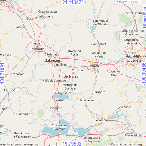
De Parral GPS coordinates[2]
20° 27' 21.996" North, 101° 0' 28.008" West
| Map corner | latitude | longitude |
|---|---|---|
| Upper-left | 21.11347°, | -101.71091° |
| Center: | 20.45611°, | -101.00778° |
| Lower-right: | 19.79592°, | -100.30466° |
| Map W x H: | 146.5×146.5 km | = 91×91mi |
| max Lat: | 32.7° ⇑33.2% North |
| De Parral: | 20.45611° |
| min Lat: | ⇓66.8% South 14.53588° |
| min Long | De Parral | max Long |
| -117.105° | -101.00778° | -86.73105° |
| W 26.5%⇐ | ⇒73.5% E |
Elevation
Elevation of De Parral is 1732 m = 5682 ft, and this is 478.3 m = 1569 ft above average elevation for this country.
| Max E: |
3497 m = 11473 ft | 39.6% |
| De Parral | 1732 m 5682 ft | |
| Avg. | 1253.7 m = 4113 ft | |
Min E: |
-1 m = -3 ft | 60.4% |
See also: Mexico elevation on elevation.city.
Geographical zone
De Parral is located in North Torrid zone (between Equator and Tropic of Cancer). Distance of this Northern Tropic circle is 331.4 km =205.9 mi to North.| Distance of | km | miles | from De Parral |
|---|---|---|---|
| North Pole | 7732.6 | 4804.8 | to North |
| Arctic Circle | 5126.7 | 3185.6 | to North |
| Tropic Cancer | 331.4 | 205.9 | to North |
| Equator | 2274.5 | 1413.3 | to South |


Nearby cities:
15 places around De Parral: (largest is in red/bold)
• Colonia Emiliano Zapata
6.2 km =3.9 mi,  26°
26°
• Colonia Morelos (El Chiquiador)
5.7 km =3.5 mi,  276°
276°
• Colonia la Calzada (La Olla)
7.3 km =4.5 mi,  44°
44°
• Cortazar
5.6 km =3.5 mi,  57°
57°
• El Diezmo
3.1 km =1.9 mi,  196°
196°
• El Huizache
6.5 km =4 mi,  129°
129°
• El Molinito
7.3 km =4.5 mi,  244°
244°
• El Nacimiento
6.9 km =4.3 mi,  290°
290°
• La Mocha
5.7 km =3.5 mi,  170°
170°
• San José del Cerrito de Camargo
5.5 km =3.4 mi,  221°
221°
• San Nicolás de Manantiales
8.1 km =5 mi,  145°
145°
• Sotelo
7.3 km =4.5 mi,  271°
271°
• Tierra Fría
3.3 km =2.1 mi, 280°
• Valencia de Fuentes
4.5 km =2.8 mi,  107°
107°
• Villagrán
6.6 km =4.1 mi,  9°
9°
Sources, notices
• [Note1] Compared only with cities in Mexico existing in our database
• [Src1] Map data: © OpenStreetMap contributors (CC-BY-SA)
• [Src2] Other city data from geonames.org with taken over terms of usage.
• [Src3] Geographical zone / Annual Mean Temperature by Robert A. Rohde @ Wikipedia
