San Nicolás de Manantiales geodata
San Nicolás de Manantiales (Guanajuato) is a populated place; located in Mexico in America/Mexico_City (GMT-6) time zone. With population of 654 people, there are 13268 cities with bigger population in this country. Compared to other cities in Mexico, 65.6% of cities are located further ↓South; 73.2% of cities are located further →East and 62.1% of cities have lower elevation than San Nicolás de Manantiales. Note1
Current local time in San Nicolás de Manantiales:
07:05 AM, WednesdayDifference from your time zone: hours


San Nicolás de Manantiales GPS coordinates[2]
20° 23' 45.564" North, 100° 57' 52.02" West
| Map corner | latitude | longitude |
|---|---|---|
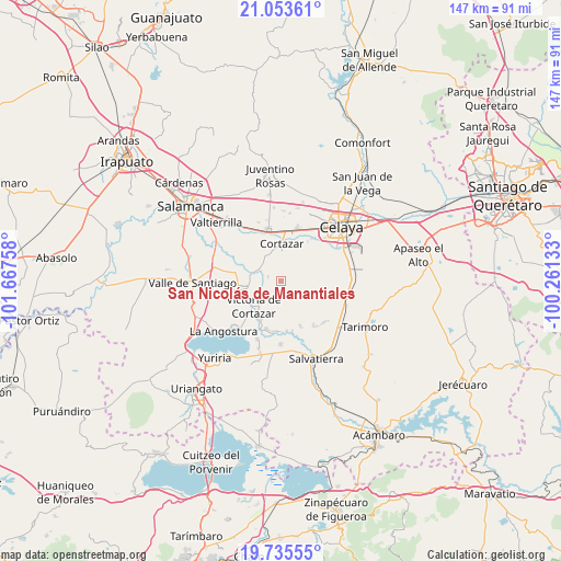
| Upper-left | 21.05361°, | -101.66758° |
| Center: | 20.39599°, | -100.96445° |
| Lower-right: | 19.73555°, | -100.26133° |
| Map W x H: | 146.6×146.6 km | = 91.1×91.1mi |
| max Lat: | 32.7° ⇑34.4% North |
| San Nicolás de Manantiales: | 20.39599° |
| min Lat: | ⇓65.6% South 14.53588° |
| min Long | San Nicolás de | max Long |
| -117.105° | -100.96445° | -86.73105° |
| W 26.8%⇐ | ⇒73.2% E |
Elevation
Elevation of San Nicolás de Manantiales is 1761 m = 5778 ft, and this is 507.3 m = 1664 ft above average elevation for this country.
| Max E: |
3497 m = 11473 ft | 37.9% |
| San Nicolás de Manantiales | 1761 m 5778 ft | |
| Avg. | 1253.7 m = 4113 ft | |
Min E: |
-1 m = -3 ft | 62.1% |
See also: Mexico elevation on elevation.city.
Geographical zone
San Nicolás de Manantiales is located in North Torrid zone (between Equator and Tropic of Cancer). Distance of this Northern Tropic circle is 338.1 km =210.1 mi to North.| Distance of | km | miles | from San Nicolás de Manantiales |
|---|---|---|---|
| North Pole | 7739.2 | 4808.9 | to North |
| Arctic Circle | 5133.4 | 3189.7 | to North |
| Tropic Cancer | 338.1 | 210.1 | to North |
| Equator | 2267.8 | 1409.1 | to South |


Nearby cities:
15 places around San Nicolás de Manantiales: (largest is in red/bold)
• Cañada de Caracheo
3 km =1.9 mi,  139°
139°
• Cortazar
9.7 km =6 mi,  1°
1°
• De Parral
8.1 km =5 mi,  325°
325°
• El Diezmo
6.5 km =4 mi,  304°
304°
• El Huizache
2.6 km =1.6 mi,  10°
10°
• El Zapote
5.1 km =3.2 mi,  45°
45°
• La Gavia
8.7 km =5.4 mi,  91°
91°
• La Huerta
10 km =6.2 mi,  19°
19°
• La Mocha
3.7 km =2.3 mi,  287°
287°
• Providencia
7.3 km =4.5 mi,  230°
230°
• San Isidro Culiacán
4.8 km =3 mi, 225°
• San José de Ojo Zarco
10 km =6.2 mi,  217°
217°
• San José del Cerrito de Camargo
8.5 km =5.3 mi, 287°
• Valencia de Fuentes
5.3 km =3.3 mi,  358°
358°
• Victoria de Cortazar
9.8 km =6.1 mi, 225°
Sources, notices
• [Note1] Compared only with cities in Mexico existing in our database
• [Src1] Map data: © OpenStreetMap contributors (CC-BY-SA)
• [Src2] Other city data from geonames.org with taken over terms of usage.
• [Src3] Geographical zone / Annual Mean Temperature by Robert A. Rohde @ Wikipedia
