El Huizache geodata
El Huizache (Guanajuato) is a populated place; located in Mexico in America/Mexico_City (GMT-6) time zone. With population of 1,910 people, there are 4552 cities with bigger population in this country. Compared to other cities in Mexico, 66.1% of cities are located further ↓South; 73.2% of cities are located further →East and 64.1% of cities have lower elevation than El Huizache. Note1


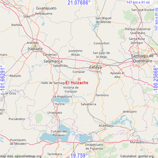
El Huizache GPS coordinates[2]
20° 25' 9.624" North, 100° 57' 35.208" West
| Map corner | latitude | longitude |
|---|---|---|
| Upper-left | 21.07686°, | -101.66291° |
| Center: | 20.41934°, | -100.95978° |
| Lower-right: | 19.759°, | -100.25666° |
| Map W x H: | 146.5×146.5 km | = 91×91mi |
| max Lat: | 32.7° ⇑33.9% North |
| El Huizache: | 20.41934° |
| min Lat: | ⇓66.1% South 14.53588° |
| min Long | El Huizache | max Long |
| -117.105° | -100.95978° | -86.73105° |
| W 26.8%⇐ | ⇒73.2% E |
Elevation
Elevation of El Huizache is 1804 m = 5919 ft, and this is 550.3 m = 1805 ft above average elevation for this country.
| Max E: |
3497 m = 11473 ft | 35.9% |
| El Huizache | 1804 m 5919 ft | |
| Avg. | 1253.7 m = 4113 ft | |
Min E: |
-1 m = -3 ft | 64.1% |
See also: Mexico elevation on elevation.city.
Geographical zone
El Huizache is located in North Torrid zone (between Equator and Tropic of Cancer). Distance of this Northern Tropic circle is 335.5 km =208.5 mi to North.| Distance of | km | miles | from El Huizache |
|---|---|---|---|
| North Pole | 7736.6 | 4807.3 | to North |
| Arctic Circle | 5130.8 | 3188.1 | to North |
| Tropic Cancer | 335.5 | 208.5 | to North |
| Equator | 2270.4 | 1410.8 | to South |


Nearby cities:
15 places around El Huizache: (largest is in red/bold)
• Cañada de Caracheo
5.1 km =3.2 mi,  163°
163°
• Colonia la Calzada (La Olla)
9.3 km =5.8 mi,  0°
0°
• Cortazar
7.2 km =4.5 mi,  357°
357°
• De Parral
6.5 km =4 mi,  309°
309°
• El Diezmo
6 km =3.7 mi,  280°
280°
• El Zapote
3.3 km =2.1 mi,  71°
71°
• La Gavia
8.6 km =5.3 mi,  108°
108°
• La Huerta
7.4 km =4.6 mi,  22°
22°
• La Mocha
4.3 km =2.7 mi,  249°
249°
• Providencia
9.5 km =5.9 mi,  220°
220°
• San Isidro Culiacán
7.1 km =4.4 mi,  213°
213°
• San José del Cerrito de Camargo
8.6 km =5.3 mi,  269°
269°
• San Nicolás de Manantiales
2.6 km =1.6 mi,  190°
190°
• Tierra Fría
9.5 km =5.9 mi,  299°
299°
• Valencia de Fuentes
2.8 km =1.7 mi,  346°
346°
Sources, notices
• [Note1] Compared only with cities in Mexico existing in our database
• [Src1] Map data: © OpenStreetMap contributors (CC-BY-SA)
• [Src2] Other city data from geonames.org with taken over terms of usage.
• [Src3] Geographical zone / Annual Mean Temperature by Robert A. Rohde @ Wikipedia
