Rancho Alegre geodata
Rancho Alegre (Veracruz) is a populated place; located in Mexico in America/Mexico_City (GMT-6) time zone. With population of 1,065 people, there are 8190 cities with bigger population in this country. Compared to other cities in Mexico, 61.5% of cities are located further ↓South; 68% of cities are located further ←West and 69.1% of cities have higher elevation than Rancho Alegre. Note1


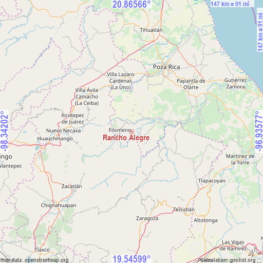
Rancho Alegre GPS coordinates[2]
20° 12' 25.992" North, 97° 38' 20.004" West
| Map corner | latitude | longitude |
|---|---|---|
| Upper-left | 20.86566°, | -98.34202° |
| Center: | 20.20722°, | -97.63889° |
| Lower-right: | 19.54599°, | -96.93577° |
| Map W x H: | 146.7×146.7 km | = 91.2×91.2mi |
| max Lat: | 32.7° ⇑38.5% North |
| Rancho Alegre: | 20.20722° |
| min Lat: | ⇓61.5% South 14.53588° |
| min Long | Rancho Alegre | max Long |
| -117.105° | -97.63889° | -86.73105° |
| W 68%⇐ | ⇒32% E |
Elevation
Elevation of Rancho Alegre is 464 m = 1522 ft, and this is 789.7 m = 2591 ft below average elevation for this country.
| Max E: |
3497 m = 11473 ft | 69.1% |
| Avg. | 1253.7 m = 4113 ft | |
| Rancho Alegre | 464 m = 1522 ft | |
Min E: |
-1 m = -3 ft | 30.9% |
See also: Mexico elevation on elevation.city.
Geographical zone
Rancho Alegre is located in North Torrid zone (between Equator and Tropic of Cancer). Distance of this Northern Tropic circle is 359.1 km =223.1 mi to North.| Distance of | km | miles | from Rancho Alegre |
|---|---|---|---|
| North Pole | 7760.2 | 4822 | to North |
| Arctic Circle | 5154.3 | 3202.7 | to North |
| Tropic Cancer | 359.1 | 223.1 | to North |
| Equator | 2246.8 | 1396.1 | to South |


Nearby cities:
15 places around Rancho Alegre: (largest is in red/bold)
• Calalco
1.3 km =0.8 mi,  48°
48°
• Cerro Grande
5.7 km =3.5 mi,  307°
307°
• Chumatlán
4.7 km =2.9 mi,  92°
92°
• Coxquihui
6.1 km =3.8 mi,  114°
114°
• Coyutla
4.9 km =3 mi,  335°
335°
• Dimas López
5.2 km =3.2 mi,  177°
177°
• El Crucero
6.6 km =4.1 mi,  280°
280°
• Francisco Villa
3.2 km =2 mi,  196°
196°
• La Cruz
3.4 km =2.1 mi,  256°
256°
• Las Lomas
6.4 km =4 mi,  22°
22°
• Lázaro Cárdenas (Santana)
5.2 km =3.2 mi,  67°
67°
• Manantiales
3.2 km =2 mi, 108°
• Mecatlán
4.5 km =2.8 mi,  274°
274°
• Putlunichuchut (Vista Hermosa)
6.2 km =3.9 mi,  156°
156°
• Ricardo Flores Magón
2.6 km =1.6 mi,  129°
129°
Sources, notices
• [Note1] Compared only with cities in Mexico existing in our database
• [Src1] Map data: © OpenStreetMap contributors (CC-BY-SA)
• [Src2] Other city data from geonames.org with taken over terms of usage.
• [Src3] Geographical zone / Annual Mean Temperature by Robert A. Rohde @ Wikipedia
