Barrio de Guadalupe geodata
Barrio de Guadalupe (San Luis Potosí) is a populated place; located in Mexico in America/Mexico_City (GMT-6) time zone. With population of 970 people, there are 8961 cities with bigger population in this country. Compared to other cities in Mexico, 79.5% of cities are located further ↓South; 52.2% of cities are located further ←West and 76.4% of cities have higher elevation than Barrio de Guadalupe. Note1


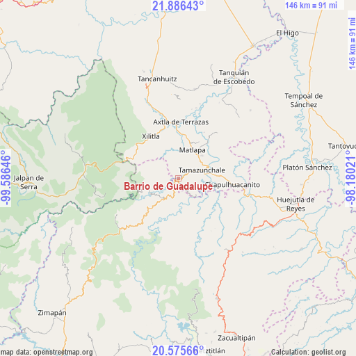
Barrio de Guadalupe GPS coordinates[2]
21° 13' 57" North, 98° 52' 59.988" West
| Map corner | latitude | longitude |
|---|---|---|
| Upper-left | 21.88643°, | -99.58646° |
| Center: | 21.2325°, | -98.88333° |
| Lower-right: | 20.57566°, | -98.18021° |
| Map W x H: | 145.7×145.7 km | = 90.5×90.5mi |
| max Lat: | 32.7° ⇑20.5% North |
| Barrio de Guadalupe: | 21.2325° |
| min Lat: | ⇓79.5% South 14.53588° |
| min Long | Barrio de Guada | max Long |
| -117.105° | -98.88333° | -86.73105° |
| W 52.2%⇐ | ⇒47.8% E |
Elevation
Elevation of Barrio de Guadalupe is 172 m = 564 ft, and this is 1081.7 m = 3549 ft below average elevation for this country.
| Max E: |
3497 m = 11473 ft | 76.4% |
| Avg. | 1253.7 m = 4113 ft | |
| Barrio de Guadalupe | 172 m = 564 ft | |
Min E: |
-1 m = -3 ft | 23.6% |
See also: Mexico elevation on elevation.city.
Geographical zone
Barrio de Guadalupe is located in North Torrid zone (between Equator and Tropic of Cancer). Distance of this Northern Tropic circle is 245.1 km =152.3 mi to North.| Distance of | km | miles | from Barrio de Guadalupe |
|---|---|---|---|
| North Pole | 7646.2 | 4751.1 | to North |
| Arctic Circle | 5040.3 | 3131.9 | to North |
| Tropic Cancer | 245.1 | 152.3 | to North |
| Equator | 2360.8 | 1466.9 | to South |


Nearby cities:
15 places around Barrio de Guadalupe: (largest is in red/bold)
• Amatitla Santiago
2.9 km =1.8 mi,  118°
118°
• Amatitla Tamán
2.7 km =1.7 mi,  105°
105°
• Barrio Progreso
2.9 km =1.8 mi,  151°
151°
• Coyol (Vega Larga)
5 km =3.1 mi,  39°
39°
• Guaxcuaco
3.2 km =2 mi,  172°
172°
• Huazalingo
4 km =2.5 mi,  70°
70°
• Ixtla (Ixtla Santiago)
4.5 km =2.8 mi,  138°
138°
• La Ameca
5.1 km =3.2 mi,  289°
289°
• Papatlaco Santiago
4.3 km =2.7 mi,  99°
99°
• San Francisco
5.3 km =3.3 mi,  351°
351°
• Santiago Centro
3.7 km =2.3 mi, 145°
• Tamán
0.4 km =0.2 mi, 95°
• Tlacuilola
1.7 km =1.1 mi, 70°
• Vega Larga
5.3 km =3.3 mi,  59°
59°
• Xaltipa
3.1 km =1.9 mi,  54°
54°
Sources, notices
• [Note1] Compared only with cities in Mexico existing in our database
• [Src1] Map data: © OpenStreetMap contributors (CC-BY-SA)
• [Src2] Other city data from geonames.org with taken over terms of usage.
• [Src3] Geographical zone / Annual Mean Temperature by Robert A. Rohde @ Wikipedia
