San Francisco geodata
San Francisco (San Luis Potosí) is a populated place; located in Mexico in America/Mexico_City (GMT-6) time zone. With population of 1,045 people, there are 8336 cities with bigger population in this country. Compared to other cities in Mexico, 79.8% of cities are located further ↓South; 52.1% of cities are located further ←West and 59.8% of cities have higher elevation than San Francisco. Note1


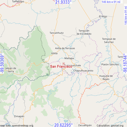
San Francisco GPS coordinates[2]
21° 16' 46.488" North, 98° 53' 26.016" West
| Map corner | latitude | longitude |
|---|---|---|
| Upper-left | 21.9333°, | -99.59369° |
| Center: | 21.27958°, | -98.89056° |
| Lower-right: | 20.62295°, | -98.18744° |
| Map W x H: | 145.7×145.7 km | = 90.5×90.5mi |
| max Lat: | 32.7° ⇑20.2% North |
| San Francisco: | 21.27958° |
| min Lat: | ⇓79.8% South 14.53588° |
| min Long | San Francisco | max Long |
| -117.105° | -98.89056° | -86.73105° |
| W 52.1%⇐ | ⇒47.9% E |
Elevation
Elevation of San Francisco is 1012 m = 3320 ft, and this is 241.7 m = 793 ft below average elevation for this country.
| Max E: |
3497 m = 11473 ft | 59.8% |
| Avg. | 1253.7 m = 4113 ft | |
| San Francisco | 1012 m = 3320 ft | |
Min E: |
-1 m = -3 ft | 40.2% |
See also: Mexico elevation on elevation.city.
Geographical zone
San Francisco is located in North Torrid zone (between Equator and Tropic of Cancer). Distance of this Northern Tropic circle is 239.9 km =149.1 mi to North.| Distance of | km | miles | from San Francisco |
|---|---|---|---|
| North Pole | 7641 | 4747.9 | to North |
| Arctic Circle | 5035.1 | 3128.7 | to North |
| Tropic Cancer | 239.9 | 149.1 | to North |
| Equator | 2366.1 | 1470.2 | to South |


Nearby cities:
15 places around San Francisco: (largest is in red/bold)
• Amatitla Tamán
6.8 km =4.2 mi,  150°
150°
• Barrio de Guadalupe
5.3 km =3.3 mi,  171°
171°
• Coaquentla
3.6 km =2.2 mi,  352°
352°
• Coyol (Vega Larga)
4.2 km =2.6 mi,  109°
109°
• Huazalingo
6 km =3.7 mi,  130°
130°
• La Ameca
5.4 km =3.4 mi,  229°
229°
• La Arena
6.2 km =3.9 mi,  263°
263°
• Las Moras
5.8 km =3.6 mi,  279°
279°
• Pahuayo Primero
4.5 km =2.8 mi, 354°
• Tamán
5.4 km =3.4 mi, 167°
• Tlacohuaque
6.5 km =4 mi,  343°
343°
• Tlacuilola
5.2 km =3.2 mi, 153°
• Vega Larga
5.9 km =3.7 mi,  116°
116°
• Xaltipa
4.8 km =3 mi,  136°
136°
• Zacayo
4.9 km =3 mi,  331°
331°
Sources, notices
• [Note1] Compared only with cities in Mexico existing in our database
• [Src1] Map data: © OpenStreetMap contributors (CC-BY-SA)
• [Src2] Other city data from geonames.org with taken over terms of usage.
• [Src3] Geographical zone / Annual Mean Temperature by Robert A. Rohde @ Wikipedia
