La Troja (El Chiflido) geodata
La Troja (El Chiflido) (Guanajuato) is a populated place; located in Mexico in America/Mexico_City (GMT-6) time zone. With population of 869 people, there are 10053 cities with bigger population in this country. Compared to other cities in Mexico, 65.2% of cities are located further ↓South; 78.9% of cities are located further →East and 58.5% of cities have lower elevation than La Troja (El Chiflido). Note1
Current local time in La Troja (El Chiflido):
06:55 AM, WednesdayDifference from your time zone: hours


La Troja (El Chiflido) GPS coordinates[2]
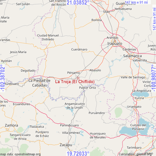
20° 22' 50.988" North, 101° 41' 2.004" West
| Map corner | latitude | longitude |
|---|---|---|
| Upper-left | 21.03852°, | -102.38702° |
| Center: | 20.38083°, | -101.68389° |
| Lower-right: | 19.72033°, | -100.98077° |
| Map W x H: | 146.6×146.6 km | = 91.1×91.1mi |
| max Lat: | 32.7° ⇑34.8% North |
| La Troja (El Chiflido): | 20.38083° |
| min Lat: | ⇓65.2% South 14.53588° |
| min Long | La Troja (El Ch | max Long |
| -117.105° | -101.68389° | -86.73105° |
| W 21.1%⇐ | ⇒78.9% E |
Elevation
Elevation of La Troja (El Chiflido) is 1698 m = 5571 ft, and this is 444.3 m = 1458 ft above average elevation for this country.
| Max E: |
3497 m = 11473 ft | 41.5% |
| La Troja (El Chiflido) | 1698 m 5571 ft | |
| Avg. | 1253.7 m = 4113 ft | |
Min E: |
-1 m = -3 ft | 58.5% |
See also: Mexico elevation on elevation.city.
Geographical zone
La Troja (El Chiflido) is located in North Torrid zone (between Equator and Tropic of Cancer). Distance of this Northern Tropic circle is 339.8 km =211.1 mi to North.| Distance of | km | miles | from La Troja (El Chiflido) |
|---|---|---|---|
| North Pole | 7740.9 | 4810 | to North |
| Arctic Circle | 5135 | 3190.7 | to North |
| Tropic Cancer | 339.8 | 211.1 | to North |
| Equator | 2266.1 | 1408.1 | to South |


Nearby cities:
15 places around La Troja (El Chiflido): (largest is in red/bold)
• Capilla de Marquéz
5 km =3.1 mi,  92°
92°
• Churipitzeo
7 km =4.3 mi,  299°
299°
• Colorado de Saavedra
7.5 km =4.7 mi,  248°
248°
• Concepción de Ruiz
7.1 km =4.4 mi,  84°
84°
• El Pedregal de Arriba
3.2 km =2 mi,  312°
312°
• El Tlacuache
7.9 km =4.9 mi,  224°
224°
• Estación Pénjamo
1.8 km =1.1 mi,  331°
331°
• La Granjena
3 km =1.9 mi,  59°
59°
• Noria de Barajas
5.2 km =3.2 mi,  160°
160°
• Ordeñita de Barajas
3.8 km =2.4 mi,  165°
165°
• Purísima de Ramírez (Los Oriones)
7.4 km =4.6 mi,  38°
38°
• Pénjamo
6.9 km =4.3 mi,  324°
324°
• Rancho Seco de Barajas
2.1 km =1.3 mi,  193°
193°
• San Antonio de Aguirre (San Vicente)
4.8 km =3 mi,  244°
244°
• Zapote de Barajas
1.8 km =1.1 mi, 249°
Sources, notices
• [Note1] Compared only with cities in Mexico existing in our database
• [Src1] Map data: © OpenStreetMap contributors (CC-BY-SA)
• [Src2] Other city data from geonames.org with taken over terms of usage.
• [Src3] Geographical zone / Annual Mean Temperature by Robert A. Rohde @ Wikipedia
