Los Cedros Suchitepec geodata
Los Cedros Suchitepec (State of Mexico) is a populated place; located in Mexico in America/Mexico_City (GMT-6) time zone. With population of 819 people, there are 10664 cities with bigger population in this country. Compared to other cities in Mexico, 53.9% of cities are located further ↑North; 64.4% of cities are located further →East and 97.5% of cities have lower elevation than Los Cedros Suchitepec. Note1


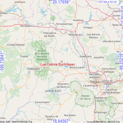
Los Cedros Suchitepec GPS coordinates[2]
19° 30' 33.012" North, 100° 2' 7.008" West
| Map corner | latitude | longitude |
|---|---|---|
| Upper-left | 20.17056°, | -100.73841° |
| Center: | 19.50917°, | -100.03528° |
| Lower-right: | 18.84507°, | -99.33216° |
| Map W x H: | 147.4×147.4 km | = 91.6×91.6mi |
| max Lat: | 32.7° ⇑53.9% North |
| Los Cedros Suchitepec: | 19.50917° |
| min Lat: | ⇓46.1% South 14.53588° |
| min Long | Los Cedros Such | max Long |
| -117.105° | -100.03528° | -86.73105° |
| W 35.6%⇐ | ⇒64.4% E |
Elevation
Elevation of Los Cedros Suchitepec is 2716 m = 8911 ft, and this is 1462.3 m = 4798 ft above average elevation for this country.
| Max E: |
3497 m = 11473 ft | 2.5% |
| Los Cedros Suchitepec | 2716 m 8911 ft | |
| Avg. | 1253.7 m = 4113 ft | |
Min E: |
-1 m = -3 ft | 97.5% |
See also: Mexico elevation on elevation.city.
Geographical zone
Los Cedros Suchitepec is located in North Torrid zone (between Equator and Tropic of Cancer). Distance of this Northern Tropic circle is 436.7 km =271.4 mi to North.| Distance of | km | miles | from Los Cedros Suchitepec |
|---|---|---|---|
| North Pole | 7837.8 | 4870.2 | to North |
| Arctic Circle | 5232 | 3251 | to North |
| Tropic Cancer | 436.7 | 271.4 | to North |
| Equator | 2169.2 | 1347.9 | to South |


Nearby cities:
15 places around Los Cedros Suchitepec: (largest is in red/bold)
• Agua Grande
2.9 km =1.8 mi,  28°
28°
• Agua Zarca
4.5 km =2.8 mi,  20°
20°
• Barrio el Centenario
4.3 km =2.7 mi,  76°
76°
• Casas Coloradas
4.5 km =2.8 mi,  206°
206°
• Cerrillo Grande
1.7 km =1.1 mi,  322°
322°
• Cuadrilla Vieja
5.1 km =3.2 mi,  86°
86°
• El Espinal
5.3 km =3.3 mi, 209°
• El Potrero de San Diego
5.4 km =3.4 mi,  245°
245°
• La Alameda
6 km =3.7 mi, 89°
• La Puerta del Pilar
5.8 km =3.6 mi,  159°
159°
• Loma de Guadalupe
3.6 km =2.2 mi, 89°
• Nuevo Bosque
1.5 km =0.9 mi,  178°
178°
• Ramejé
2.9 km =1.8 mi,  49°
49°
• San Diego del Cerrito
3 km =1.9 mi, 92°
• San Felipe de la Rosa
2.7 km =1.7 mi,  221°
221°
Sources, notices
• [Note1] Compared only with cities in Mexico existing in our database
• [Src1] Map data: © OpenStreetMap contributors (CC-BY-SA)
• [Src2] Other city data from geonames.org with taken over terms of usage.
• [Src3] Geographical zone / Annual Mean Temperature by Robert A. Rohde @ Wikipedia
