Cuadrilla Vieja geodata
Cuadrilla Vieja (State of Mexico) is a populated place; located in Mexico in America/Mexico_City (GMT-6) time zone. With population of 1,015 people, there are 8582 cities with bigger population in this country. Compared to other cities in Mexico, 53.8% of cities are located further ↑North; 63.8% of cities are located further →East and 95.9% of cities have lower elevation than Cuadrilla Vieja. Note1


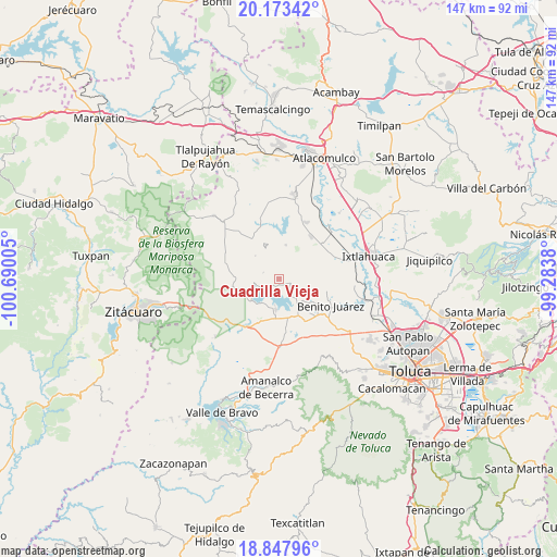
Cuadrilla Vieja GPS coordinates[2]
19° 30' 43.38" North, 99° 59' 12.912" West
| Map corner | latitude | longitude |
|---|---|---|
| Upper-left | 20.17342°, | -100.69005° |
| Center: | 19.51205°, | -99.98692° |
| Lower-right: | 18.84796°, | -99.2838° |
| Map W x H: | 147.4×147.4 km | = 91.6×91.6mi |
| max Lat: | 32.7° ⇑53.8% North |
| Cuadrilla Vieja: | 19.51205° |
| min Lat: | ⇓46.2% South 14.53588° |
| min Long | Cuadrilla Vieja | max Long |
| -117.105° | -99.98692° | -86.73105° |
| W 36.2%⇐ | ⇒63.8% E |
Elevation
Elevation of Cuadrilla Vieja is 2621 m = 8599 ft, and this is 1367.3 m = 4486 ft above average elevation for this country.
| Max E: |
3497 m = 11473 ft | 4.1% |
| Cuadrilla Vieja | 2621 m 8599 ft | |
| Avg. | 1253.7 m = 4113 ft | |
Min E: |
-1 m = -3 ft | 95.9% |
See also: Mexico elevation on elevation.city.
Geographical zone
Cuadrilla Vieja is located in North Torrid zone (between Equator and Tropic of Cancer). Distance of this Northern Tropic circle is 436.4 km =271.2 mi to North.| Distance of | km | miles | from Cuadrilla Vieja |
|---|---|---|---|
| North Pole | 7837.5 | 4870 | to North |
| Arctic Circle | 5231.6 | 3250.8 | to North |
| Tropic Cancer | 436.4 | 271.2 | to North |
| Equator | 2169.5 | 1348.1 | to South |


Nearby cities:
15 places around Cuadrilla Vieja: (largest is in red/bold)
• Agua Grande
4.3 km =2.7 mi,  301°
301°
• Agua Zarca
5.2 km =3.2 mi,  317°
317°
• Barrio de Centro del Cerrillo
4.4 km =2.7 mi,  51°
51°
• Barrio de Puentecillas
2.6 km =1.6 mi,  5°
5°
• Barrio de San Isidro
3.1 km =1.9 mi,  70°
70°
• Barrio de San Miguel
3.4 km =2.1 mi,  89°
89°
• Barrio el Centenario
1.1 km =0.7 mi,  307°
307°
• La Alameda
1 km =0.6 mi,  103°
103°
• La Campanilla
4.7 km =2.9 mi, 93°
• Loma de Guadalupe
1.5 km =0.9 mi,  258°
258°
• Los Cedros Suchitepec
5.1 km =3.2 mi,  266°
266°
• Ramejé
3.2 km =2 mi, 299°
• San Diego del Cerrito
2.1 km =1.3 mi, 257°
• San Marcos de la Loma
3 km =1.9 mi,  113°
113°
• San Roque
4.5 km =2.8 mi,  141°
141°
Sources, notices
• [Note1] Compared only with cities in Mexico existing in our database
• [Src1] Map data: © OpenStreetMap contributors (CC-BY-SA)
• [Src2] Other city data from geonames.org with taken over terms of usage.
• [Src3] Geographical zone / Annual Mean Temperature by Robert A. Rohde @ Wikipedia
