Ex-Presidentes geodata
Ex-Presidentes (Hidalgo) is a populated place; located in Mexico in America/Mexico_City (GMT-6) time zone. With population of 812 people, there are 10760 cities with bigger population in this country. Compared to other cities in Mexico, 54.2% of cities are located further ↓South; 50.8% of cities are located further ←West and 86% of cities have lower elevation than Ex-Presidentes. Note1


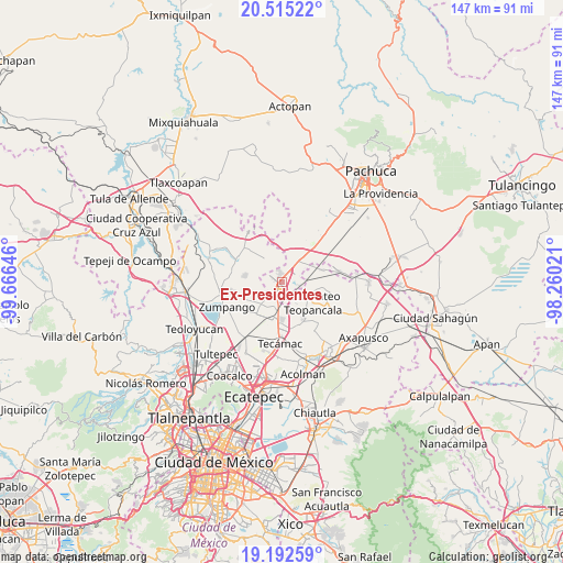
Ex-Presidentes GPS coordinates[2]
19° 51' 19.008" North, 98° 57' 47.988" West
| Map corner | latitude | longitude |
|---|---|---|
| Upper-left | 20.51522°, | -99.66646° |
| Center: | 19.85528°, | -98.96333° |
| Lower-right: | 19.19259°, | -98.26021° |
| Map W x H: | 147.1×147.1 km | = 91.4×91.4mi |
| max Lat: | 32.7° ⇑45.8% North |
| Ex-Presidentes: | 19.85528° |
| min Lat: | ⇓54.2% South 14.53588° |
| min Long | Ex-Presidentes | max Long |
| -117.105° | -98.96333° | -86.73105° |
| W 50.8%⇐ | ⇒49.2% E |
Elevation
Elevation of Ex-Presidentes is 2283 m = 7490 ft, and this is 1029.3 m = 3377 ft above average elevation for this country.
| Max E: |
3497 m = 11473 ft | 14% |
| Ex-Presidentes | 2283 m 7490 ft | |
| Avg. | 1253.7 m = 4113 ft | |
Min E: |
-1 m = -3 ft | 86% |
See also: Mexico elevation on elevation.city.
Geographical zone
Ex-Presidentes is located in North Torrid zone (between Equator and Tropic of Cancer). Distance of this Northern Tropic circle is 398.2 km =247.4 mi to North.| Distance of | km | miles | from Ex-Presidentes |
|---|---|---|---|
| North Pole | 7799.4 | 4846.3 | to North |
| Arctic Circle | 5193.5 | 3227.1 | to North |
| Tropic Cancer | 398.2 | 247.4 | to North |
| Equator | 2207.7 | 1371.8 | to South |


Nearby cities:
15 places around Ex-Presidentes: (largest is in red/bold)
• Colonia San Juan de Guadalupe
5.7 km =3.5 mi,  213°
213°
• Colonia los Alcanfores
6.5 km =4 mi,  239°
239°
• Don Antonio
3.7 km =2.3 mi,  54°
54°
• El Carmen
3.7 km =2.3 mi,  9°
9°
• El Cid
4 km =2.5 mi,  70°
70°
• Ex-Hacienda de Guadalupe
5.2 km =3.2 mi,  190°
190°
• General Felipe Ángeles (Los Ángeles)
6.1 km =3.8 mi,  39°
39°
• Huitzila
4.9 km =3 mi,  170°
170°
• Las Plazas
2.7 km =1.7 mi, 50°
• Olmos
4.7 km =2.9 mi, 54°
• Presa del Rey
6.2 km =3.9 mi,  83°
83°
• San Bartolo Cuautlalpan
6.7 km =4.2 mi,  227°
227°
• Temascalapa
7.1 km =4.4 mi,  115°
115°
• Tepojaco
2.3 km =1.4 mi,  134°
134°
• Tizayuca
2.4 km =1.5 mi, 213°
Sources, notices
• [Note1] Compared only with cities in Mexico existing in our database
• [Src1] Map data: © OpenStreetMap contributors (CC-BY-SA)
• [Src2] Other city data from geonames.org with taken over terms of usage.
• [Src3] Geographical zone / Annual Mean Temperature by Robert A. Rohde @ Wikipedia
