Ex-Hacienda de Guadalupe geodata
Ex-Hacienda de Guadalupe (State of Mexico) is a populated place; located in Mexico in America/Mexico_City (GMT-6) time zone. With population of 1,532 people, there are 5639 cities with bigger population in this country. Compared to other cities in Mexico, 53% of cities are located further ↓South; 50.6% of cities are located further ←West and 85.6% of cities have lower elevation than Ex-Hacienda de Guadalupe. Note1
Current local time in Ex-Hacienda de Guadalupe:
05:23 AM, WednesdayDifference from your time zone: hours


Ex-Hacienda de Guadalupe GPS coordinates[2]
19° 48' 32.004" North, 98° 58' 21" West
| Map corner | latitude | longitude |
|---|---|---|
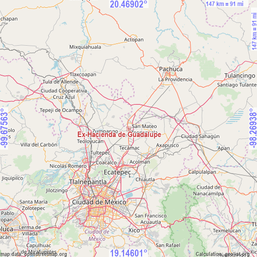
| Upper-left | 20.46902°, | -99.67563° |
| Center: | 19.80889°, | -98.9725° |
| Lower-right: | 19.14601°, | -98.26938° |
| Map W x H: | 147.1×147.1 km | = 91.4×91.4mi |
| max Lat: | 32.7° ⇑47% North |
| Ex-Hacienda de Guadalupe: | 19.80889° |
| min Lat: | ⇓53% South 14.53588° |
| min Long | Ex-Hacienda de | max Long |
| -117.105° | -98.9725° | -86.73105° |
| W 50.6%⇐ | ⇒49.4% E |
Elevation
Elevation of Ex-Hacienda de Guadalupe is 2271 m = 7451 ft, and this is 1017.3 m = 3338 ft above average elevation for this country.
| Max E: |
3497 m = 11473 ft | 14.4% |
| Ex-Hacienda de Guadalupe | 2271 m 7451 ft | |
| Avg. | 1253.7 m = 4113 ft | |
Min E: |
-1 m = -3 ft | 85.6% |
See also: Mexico elevation on elevation.city.
Geographical zone
Ex-Hacienda de Guadalupe is located in North Torrid zone (between Equator and Tropic of Cancer). Distance of this Northern Tropic circle is 403.4 km =250.7 mi to North.| Distance of | km | miles | from Ex-Hacienda de Guadalupe |
|---|---|---|---|
| North Pole | 7804.5 | 4849.5 | to North |
| Arctic Circle | 5198.6 | 3230.3 | to North |
| Tropic Cancer | 403.4 | 250.7 | to North |
| Equator | 2202.5 | 1368.6 | to South |


Nearby cities:
15 places around Ex-Hacienda de Guadalupe: (largest is in red/bold)
• Colonia San Juan de Guadalupe
2.2 km =1.4 mi,  279°
279°
• Colonia los Alcanfores
5 km =3.1 mi,  291°
291°
• Ex-Presidentes
5.2 km =3.2 mi,  10°
10°
• Hacienda los Encinos
7.1 km =4.4 mi,  265°
265°
• Huitzila
1.8 km =1.1 mi,  81°
81°
• Las Plazas
6.5 km =4 mi, 275°
• Las Plazas
7.5 km =4.7 mi,  23°
23°
• Paseos de San Juan
5.6 km =3.5 mi,  237°
237°
• Reyes Acozac
3.8 km =2.4 mi,  193°
193°
• San Bartolo Cuautlalpan
4 km =2.5 mi, 279°
• San Juan Pueblo Nuevo
6.2 km =3.9 mi,  233°
233°
• Sanata Lucía
6.8 km =4.2 mi, 187°
• Santa María Ajoloapan
5.2 km =3.2 mi,  164°
164°
• Tepojaco
4.4 km =2.7 mi,  36°
36°
• Tizayuca
3.2 km =2 mi,  353°
353°
Sources, notices
• [Note1] Compared only with cities in Mexico existing in our database
• [Src1] Map data: © OpenStreetMap contributors (CC-BY-SA)
• [Src2] Other city data from geonames.org with taken over terms of usage.
• [Src3] Geographical zone / Annual Mean Temperature by Robert A. Rohde @ Wikipedia
