Loma de Chapultepec geodata
Loma de Chapultepec (State of Mexico) is a populated place; located in Mexico in America/Mexico_City (GMT-6) time zone. With population of 812 people, there are 10760 cities with bigger population in this country. Compared to other cities in Mexico, 51.6% of cities are located further ↑North; 55.7% of cities are located further →East and 98.5% of cities have lower elevation than Loma de Chapultepec. Note1


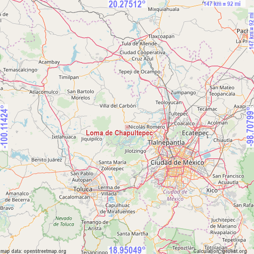
Loma de Chapultepec GPS coordinates[2]
19° 36' 51.012" North, 99° 24' 39.996" West
| Map corner | latitude | longitude |
|---|---|---|
| Upper-left | 20.27512°, | -100.11424° |
| Center: | 19.61417°, | -99.41111° |
| Lower-right: | 18.95049°, | -98.70799° |
| Map W x H: | 147.3×147.3 km | = 91.5×91.5mi |
| max Lat: | 32.7° ⇑51.6% North |
| Loma de Chapultepec: | 19.61417° |
| min Lat: | ⇓48.4% South 14.53588° |
| min Long | Loma de Chapult | max Long |
| -117.105° | -99.41111° | -86.73105° |
| W 44.3%⇐ | ⇒55.7% E |
Elevation
Elevation of Loma de Chapultepec is 2786 m = 9140 ft, and this is 1532.3 m = 5027 ft above average elevation for this country.
| Max E: |
3497 m = 11473 ft | 1.5% |
| Loma de Chapultepec | 2786 m 9140 ft | |
| Avg. | 1253.7 m = 4113 ft | |
Min E: |
-1 m = -3 ft | 98.5% |
See also: Mexico elevation on elevation.city.
Geographical zone
Loma de Chapultepec is located in North Torrid zone (between Equator and Tropic of Cancer). Distance of this Northern Tropic circle is 425 km =264.1 mi to North.| Distance of | km | miles | from Loma de Chapultepec |
|---|---|---|---|
| North Pole | 7826.2 | 4863 | to North |
| Arctic Circle | 5220.3 | 3243.7 | to North |
| Tropic Cancer | 425 | 264.1 | to North |
| Equator | 2180.9 | 1355.1 | to South |


Nearby cities:
15 places around Loma de Chapultepec: (largest is in red/bold)
• Barrio de Guadalupe
1.8 km =1.1 mi,  216°
216°
• Caja de Agua
5.8 km =3.6 mi,  56°
56°
• Colonia Llano Grande (Nuevo Ejido)
5.4 km =3.4 mi,  105°
105°
• Colonia Palma
5.7 km =3.5 mi,  193°
193°
• Colonia San Miguel
5.4 km =3.4 mi,  26°
26°
• Ejido Miraflores
5.1 km =3.2 mi,  163°
163°
• Ejido Palma (Ejido San Francisco)
5 km =3.1 mi,  177°
177°
• Loma de Guadalupe (La Biznaga)
6.1 km =3.8 mi,  46°
46°
• Miranda
3.2 km =2 mi,  331°
331°
• Puentecillas Cahuacán
4.1 km =2.5 mi,  300°
300°
• Quinto Barrio (Ejido Cahuacán)
1.2 km =0.7 mi,  320°
320°
• San José el Vidrio
5.2 km =3.2 mi, 32°
• San José los Barbechos (Los Barbechos)
3.4 km =2.1 mi,  343°
343°
• Santa María Magdalena Cahuacán
2.7 km =1.7 mi,  354°
354°
• Transfiguración
4.2 km =2.6 mi, 192°
Sources, notices
• [Note1] Compared only with cities in Mexico existing in our database
• [Src1] Map data: © OpenStreetMap contributors (CC-BY-SA)
• [Src2] Other city data from geonames.org with taken over terms of usage.
• [Src3] Geographical zone / Annual Mean Temperature by Robert A. Rohde @ Wikipedia
