Miranda geodata
Miranda (State of Mexico) is a populated place; located in Mexico in America/Mexico_City (GMT-6) time zone. With population of 659 people, there are 13168 cities with bigger population in this country. Compared to other cities in Mexico, 51.1% of cities are located further ↑North; 56% of cities are located further →East and 96.7% of cities have lower elevation than Miranda. Note1


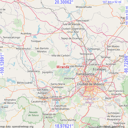
Miranda GPS coordinates[2]
19° 38' 23.208" North, 99° 25' 32.808" West
| Map corner | latitude | longitude |
|---|---|---|
| Upper-left | 20.30062°, | -100.12891° |
| Center: | 19.63978°, | -99.42578° |
| Lower-right: | 18.97621°, | -98.72266° |
| Map W x H: | 147.3×147.3 km | = 91.5×91.5mi |
| max Lat: | 32.7° ⇑51.1% North |
| Miranda: | 19.63978° |
| min Lat: | ⇓48.9% South 14.53588° |
| min Long | Miranda | max Long |
| -117.105° | -99.42578° | -86.73105° |
| W 44%⇐ | ⇒56% E |
Elevation
Elevation of Miranda is 2661 m = 8730 ft, and this is 1407.3 m = 4617 ft above average elevation for this country.
| Max E: |
3497 m = 11473 ft | 3.3% |
| Miranda | 2661 m 8730 ft | |
| Avg. | 1253.7 m = 4113 ft | |
Min E: |
-1 m = -3 ft | 96.7% |
See also: Mexico elevation on elevation.city.
Geographical zone
Miranda is located in North Torrid zone (between Equator and Tropic of Cancer). Distance of this Northern Tropic circle is 422.2 km =262.3 mi to North.| Distance of | km | miles | from Miranda |
|---|---|---|---|
| North Pole | 7823.3 | 4861.2 | to North |
| Arctic Circle | 5217.4 | 3241.9 | to North |
| Tropic Cancer | 422.2 | 262.3 | to North |
| Equator | 2183.7 | 1356.9 | to South |


Nearby cities:
15 places around Miranda: (largest is in red/bold)
• Barrio de Guadalupe
4.3 km =2.7 mi,  173°
173°
• Caja de Agua
6.4 km =4 mi,  86°
86°
• Colonia San Miguel
4.4 km =2.7 mi,  62°
62°
• El Esclavo
7 km =4.3 mi,  54°
54°
• El Ocotal
6.4 km =4 mi,  313°
313°
• Loma Alta
6 km =3.7 mi,  336°
336°
• Loma de Chapultepec
3.2 km =2 mi,  151°
151°
• Loma de Guadalupe (La Biznaga)
6.1 km =3.8 mi,  76°
76°
• Puentecillas Cahuacán
2.1 km =1.3 mi,  247°
247°
• Quinto Barrio (Ejido Cahuacán)
2.1 km =1.3 mi,  157°
157°
• San José el Vidrio
4.6 km =2.9 mi,  70°
70°
• San José los Barbechos (Los Barbechos)
0.7 km =0.4 mi, 53°
• San Juan de las Tablas
3.7 km =2.3 mi,  6°
6°
• Santa María Magdalena Cahuacán
1.3 km =0.8 mi,  98°
98°
• Transfiguración
7 km =4.3 mi, 174°
Sources, notices
• [Note1] Compared only with cities in Mexico existing in our database
• [Src1] Map data: © OpenStreetMap contributors (CC-BY-SA)
• [Src2] Other city data from geonames.org with taken over terms of usage.
• [Src3] Geographical zone / Annual Mean Temperature by Robert A. Rohde @ Wikipedia
