Las Plazas geodata
Las Plazas (State of Mexico) is a populated place; located in Mexico in America/Mexico_City (GMT-6) time zone. With population of 804 people, there are 10860 cities with bigger population in this country. Compared to other cities in Mexico, 53.2% of cities are located further ↓South; 50.3% of cities are located further →East and 85.3% of cities have lower elevation than Las Plazas. Note1


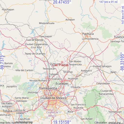
Las Plazas GPS coordinates[2]
19° 48' 51.984" North, 99° 2' 3.012" West
| Map corner | latitude | longitude |
|---|---|---|
| Upper-left | 20.47455°, | -99.7373° |
| Center: | 19.81444°, | -99.03417° |
| Lower-right: | 19.15158°, | -98.33105° |
| Map W x H: | 147.1×147.1 km | = 91.4×91.4mi |
| max Lat: | 32.7° ⇑46.8% North |
| Las Plazas: | 19.81444° |
| min Lat: | ⇓53.2% South 14.53588° |
| min Long | Las Plazas | max Long |
| -117.105° | -99.03417° | -86.73105° |
| W 49.7%⇐ | ⇒50.3% E |
Elevation
Elevation of Las Plazas is 2265 m = 7431 ft, and this is 1011.3 m = 3318 ft above average elevation for this country.
| Max E: |
3497 m = 11473 ft | 14.7% |
| Las Plazas | 2265 m 7431 ft | |
| Avg. | 1253.7 m = 4113 ft | |
Min E: |
-1 m = -3 ft | 85.3% |
See also: Mexico elevation on elevation.city.
Geographical zone
Las Plazas is located in North Torrid zone (between Equator and Tropic of Cancer). Distance of this Northern Tropic circle is 402.8 km =250.3 mi to North.| Distance of | km | miles | from Las Plazas |
|---|---|---|---|
| North Pole | 7803.9 | 4849.1 | to North |
| Arctic Circle | 5198 | 3229.9 | to North |
| Tropic Cancer | 402.8 | 250.3 | to North |
| Equator | 2203.2 | 1369 | to South |


Nearby cities:
15 places around Las Plazas: (largest is in red/bold)
• Arbolada los Sauces
1.1 km =0.7 mi,  278°
278°
• Buenavista
1.5 km =0.9 mi,  220°
220°
• Colonia San Juan de Guadalupe
4.3 km =2.7 mi,  93°
93°
• Colonia los Alcanfores
2.2 km =1.4 mi,  56°
56°
• Colonia los Hornos
2 km =1.2 mi,  250°
250°
• El Llano Santa María
6.4 km =4 mi,  238°
238°
• Fraccionamiento la Trinidad
5.3 km =3.3 mi,  287°
287°
• Hacienda los Encinos
1.3 km =0.8 mi,  206°
206°
• Paseos de San Juan
4 km =2.5 mi,  154°
154°
• Pueblo Nuevo de Morelos
6.1 km =3.8 mi,  199°
199°
• San Bartolo Cuautlalpan
2.5 km =1.6 mi, 88°
• San Juan Pueblo Nuevo
4.6 km =2.9 mi,  160°
160°
• San Sebastián
4 km =2.5 mi, 213°
• Unidad Familiar Confederación de Trabajadores Campesinos
6.3 km =3.9 mi,  228°
228°
• Villas de la Laguna
6.3 km =3.9 mi, 292°
Sources, notices
• [Note1] Compared only with cities in Mexico existing in our database
• [Src1] Map data: © OpenStreetMap contributors (CC-BY-SA)
• [Src2] Other city data from geonames.org with taken over terms of usage.
• [Src3] Geographical zone / Annual Mean Temperature by Robert A. Rohde @ Wikipedia
