Aguachinola geodata
Aguachinola (Veracruz) is a populated place; located in Mexico in America/Mexico_City (GMT-6) time zone. With population of 772 people, there are 11323 cities with bigger population in this country. Compared to other cities in Mexico, 69.2% of cities are located further ↑North; 72.3% of cities are located further ←West and 51.4% of cities have higher elevation than Aguachinola. Note1


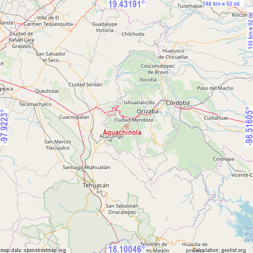
Aguachinola GPS coordinates[2]
18° 46' 3" North, 97° 13' 9.012" West
| Map corner | latitude | longitude |
|---|---|---|
| Upper-left | 19.43191°, | -97.9223° |
| Center: | 18.7675°, | -97.21917° |
| Lower-right: | 18.10046°, | -96.51605° |
| Map W x H: | 148×148 km | = 92×92mi |
| max Lat: | 32.7° ⇑69.2% North |
| Aguachinola: | 18.7675° |
| min Lat: | ⇓30.8% South 14.53588° |
| min Long | Aguachinola | max Long |
| -117.105° | -97.21917° | -86.73105° |
| W 72.3%⇐ | ⇒27.7% E |
Elevation
Elevation of Aguachinola is 1362 m = 4469 ft, and this is 108.3 m = 355 ft above average elevation for this country.
| Max E: |
3497 m = 11473 ft | 51.4% |
| Aguachinola | 1362 m 4469 ft | |
| Avg. | 1253.7 m = 4113 ft | |
Min E: |
-1 m = -3 ft | 48.6% |
See also: Mexico elevation on elevation.city.
Geographical zone
Aguachinola is located in North Torrid zone (between Equator and Tropic of Cancer). Distance of this Northern Tropic circle is 519.2 km =322.6 mi to North.| Distance of | km | miles | from Aguachinola |
|---|---|---|---|
| North Pole | 7920.3 | 4921.4 | to North |
| Arctic Circle | 5314.4 | 3302.2 | to North |
| Tropic Cancer | 519.2 | 322.6 | to North |
| Equator | 2086.8 | 1296.7 | to South |


Nearby cities:
15 places around Aguachinola: (largest is in red/bold)
• Acatla
2 km =1.2 mi,  177°
177°
• Agrícola Lázaro Cárdenas
5.6 km =3.5 mi,  23°
23°
• Campesina el Mirador
4.7 km =2.9 mi, 24°
• Cecilio Terán
5.3 km =3.3 mi,  353°
353°
• Coxolitla de Abajo
3.5 km =2.2 mi,  226°
226°
• El Campanario
2.7 km =1.7 mi,  80°
80°
• Huixtitla
3.2 km =2 mi,  124°
124°
• La Cuesta
5.9 km =3.7 mi,  64°
64°
• Paseo Nuevo
3.5 km =2.2 mi,  35°
35°
• Próspero Pineda
4.3 km =2.7 mi, 234°
• Puente de Guadalupe
4.3 km =2.7 mi, 229°
• Rancho Viejo
2.2 km =1.4 mi,  30°
30°
• Sierra de Agua
3 km =1.9 mi, 231°
• Taza de Agua Ojo Zarco
2.5 km =1.6 mi,  45°
45°
• Tecamalucan
1 km =0.6 mi,  221°
221°
Sources, notices
• [Note1] Compared only with cities in Mexico existing in our database
• [Src1] Map data: © OpenStreetMap contributors (CC-BY-SA)
• [Src2] Other city data from geonames.org with taken over terms of usage.
• [Src3] Geographical zone / Annual Mean Temperature by Robert A. Rohde @ Wikipedia
