Vista Real y Country Club geodata
Vista Real y Country Club (Querétaro) is a populated place; located in Mexico in America/Mexico_City (GMT-6) time zone. With population of 767 people, there are 11411 cities with bigger population in this country. Compared to other cities in Mexico, 68.2% of cities are located further ↓South; 68.5% of cities are located further →East and 75.4% of cities have lower elevation than Vista Real y Country Club. Note1
Current local time in Vista Real y Country Club:
08:34 AM, WednesdayDifference from your time zone: hours


Vista Real y Country Club GPS coordinates[2]
20° 31' 19.992" North, 100° 24' 9" West
| Map corner | latitude | longitude |
|---|---|---|
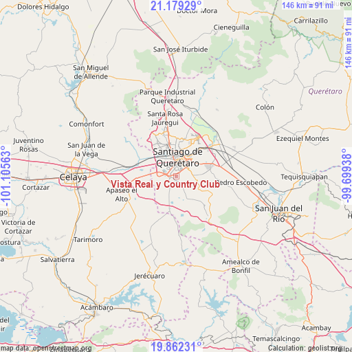
| Upper-left | 21.17929°, | -101.10563° |
| Center: | 20.52222°, | -100.4025° |
| Lower-right: | 19.86231°, | -99.69938° |
| Map W x H: | 146.4×146.4 km | = 91×91mi |
| max Lat: | 32.7° ⇑31.8% North |
| Vista Real y Country Club: | 20.52222° |
| min Lat: | ⇓68.2% South 14.53588° |
| min Long | Vista Real y Co | max Long |
| -117.105° | -100.4025° | -86.73105° |
| W 31.5%⇐ | ⇒68.5% E |
Elevation
Elevation of Vista Real y Country Club is 2038 m = 6686 ft, and this is 784.3 m = 2573 ft above average elevation for this country.
| Max E: |
3497 m = 11473 ft | 24.6% |
| Vista Real y Country Club | 2038 m 6686 ft | |
| Avg. | 1253.7 m = 4113 ft | |
Min E: |
-1 m = -3 ft | 75.4% |
See also: Mexico elevation on elevation.city.
Geographical zone
Vista Real y Country Club is located in North Torrid zone (between Equator and Tropic of Cancer). Distance of this Northern Tropic circle is 324.1 km =201.4 mi to North.| Distance of | km | miles | from Vista Real y Country Club |
|---|---|---|---|
| North Pole | 7725.2 | 4800.2 | to North |
| Arctic Circle | 5119.3 | 3181 | to North |
| Tropic Cancer | 324.1 | 201.4 | to North |
| Equator | 2281.9 | 1417.9 | to South |


Nearby cities:
15 places around Vista Real y Country Club: (largest is in red/bold)
• Apapátaro
7 km =4.3 mi,  149°
149°
• Cumbres del Cimatario
6.1 km =3.8 mi,  63°
63°
• El Milagro
7.7 km =4.8 mi,  133°
133°
• El Paraíso
1.4 km =0.9 mi,  35°
35°
• El Pueblito
4.2 km =2.6 mi,  297°
297°
• Joaquín Herrera
5.8 km =3.6 mi,  220°
220°
• La Negreta
5 km =3.1 mi,  275°
275°
• La Noria
6 km =3.7 mi,  100°
100°
• Lomas de la Cruz
5.3 km =3.3 mi,  262°
262°
• Los Olvera
1.5 km =0.9 mi,  337°
337°
• San Jose de los Olvera
3.7 km =2.3 mi, 338°
• Santiago de Querétaro
7.5 km =4.7 mi,  11°
11°
• Valle Dorado Dos Mil
7.2 km =4.5 mi, 275°
• Valle de los Pinos
6.2 km =3.9 mi,  265°
265°
• Venceremos
3.2 km =2 mi, 8°
Sources, notices
• [Note1] Compared only with cities in Mexico existing in our database
• [Src1] Map data: © OpenStreetMap contributors (CC-BY-SA)
• [Src2] Other city data from geonames.org with taken over terms of usage.
• [Src3] Geographical zone / Annual Mean Temperature by Robert A. Rohde @ Wikipedia
