El Milagro geodata
El Milagro (Querétaro) is a populated place; located in Mexico in America/Mexico_City (GMT-6) time zone. With population of 1,663 people, there are 5226 cities with bigger population in this country. Compared to other cities in Mexico, 67.2% of cities are located further ↓South; 67.9% of cities are located further →East and 73.2% of cities have lower elevation than El Milagro. Note1


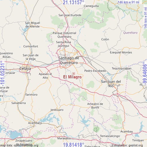
El Milagro GPS coordinates[2]
20° 28' 27.444" North, 100° 20' 57.048" West
| Map corner | latitude | longitude |
|---|---|---|
| Upper-left | 21.13157°, | -101.05231° |
| Center: | 20.47429°, | -100.34918° |
| Lower-right: | 19.81418°, | -99.64606° |
| Map W x H: | 146.5×146.5 km | = 91×91mi |
| max Lat: | 32.7° ⇑32.8% North |
| El Milagro: | 20.47429° |
| min Lat: | ⇓67.2% South 14.53588° |
| min Long | El Milagro | max Long |
| -117.105° | -100.34918° | -86.73105° |
| W 32.1%⇐ | ⇒67.9% E |
Elevation
Elevation of El Milagro is 1993 m = 6539 ft, and this is 739.3 m = 2426 ft above average elevation for this country.
| Max E: |
3497 m = 11473 ft | 26.8% |
| El Milagro | 1993 m 6539 ft | |
| Avg. | 1253.7 m = 4113 ft | |
Min E: |
-1 m = -3 ft | 73.2% |
See also: Mexico elevation on elevation.city.
Geographical zone
El Milagro is located in North Torrid zone (between Equator and Tropic of Cancer). Distance of this Northern Tropic circle is 329.4 km =204.7 mi to North.| Distance of | km | miles | from El Milagro |
|---|---|---|---|
| North Pole | 7730.5 | 4803.5 | to North |
| Arctic Circle | 5124.6 | 3184.3 | to North |
| Tropic Cancer | 329.4 | 204.7 | to North |
| Equator | 2276.5 | 1414.6 | to South |


Nearby cities:
15 places around El Milagro: (largest is in red/bold)
• Apapátaro
2.1 km =1.3 mi,  251°
251°
• Cumbres del Cimatario
8 km =5 mi,  359°
359°
• El Granjeno
6.6 km =4.1 mi,  155°
155°
• El Paraíso
8 km =5 mi,  323°
323°
• El Rosario
7 km =4.3 mi,  36°
36°
• El Vegil
4.8 km =3 mi,  181°
181°
• Guadalupe Primero
4.8 km =3 mi,  78°
78°
• La Noria
4.3 km =2.7 mi,  4°
4°
• Lagunillas
5.9 km =3.7 mi,  107°
107°
• Las Taponas
7.3 km =4.5 mi,  210°
210°
• Los Olvera
9.1 km =5.7 mi, 317°
• Puerta de San Rafael
7.3 km =4.5 mi,  230°
230°
• San Rafael
5.2 km =3.2 mi,  242°
242°
• Santa Teresa
5.4 km =3.4 mi,  65°
65°
• Vista Real y Country Club
7.7 km =4.8 mi,  313°
313°
Sources, notices
• [Note1] Compared only with cities in Mexico existing in our database
• [Src1] Map data: © OpenStreetMap contributors (CC-BY-SA)
• [Src2] Other city data from geonames.org with taken over terms of usage.
• [Src3] Geographical zone / Annual Mean Temperature by Robert A. Rohde @ Wikipedia
