Palmita de Landeta geodata
Palmita de Landeta (Guanajuato) is a populated place; located in Mexico in America/Mexico_City (GMT-6) time zone. With population of 765 people, there are 11448 cities with bigger population in this country. Compared to other cities in Mexico, 75.2% of cities are located further ↓South; 71.1% of cities are located further →East and 74.4% of cities have lower elevation than Palmita de Landeta. Note1


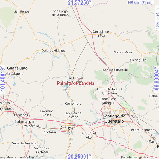
Palmita de Landeta GPS coordinates[2]
20° 55' 1.992" North, 100° 42' 11.016" West
| Map corner | latitude | longitude |
|---|---|---|
| Upper-left | 21.57256°, | -101.40619° |
| Center: | 20.91722°, | -100.70306° |
| Lower-right: | 20.25901°, | -99.99994° |
| Map W x H: | 146.1×146.1 km | = 90.8×90.8mi |
| max Lat: | 32.7° ⇑24.8% North |
| Palmita de Landeta: | 20.91722° |
| min Lat: | ⇓75.2% South 14.53588° |
| min Long | Palmita de Land | max Long |
| -117.105° | -100.70306° | -86.73105° |
| W 28.9%⇐ | ⇒71.1% E |
Elevation
Elevation of Palmita de Landeta is 2020 m = 6627 ft, and this is 766.3 m = 2514 ft above average elevation for this country.
| Max E: |
3497 m = 11473 ft | 25.6% |
| Palmita de Landeta | 2020 m 6627 ft | |
| Avg. | 1253.7 m = 4113 ft | |
Min E: |
-1 m = -3 ft | 74.4% |
See also: Mexico elevation on elevation.city.
Geographical zone
Palmita de Landeta is located in North Torrid zone (between Equator and Tropic of Cancer). Distance of this Northern Tropic circle is 280.1 km =174 mi to North.| Distance of | km | miles | from Palmita de Landeta |
|---|---|---|---|
| North Pole | 7681.3 | 4772.9 | to North |
| Arctic Circle | 5075.4 | 3153.7 | to North |
| Tropic Cancer | 280.1 | 174 | to North |
| Equator | 2325.8 | 1445.2 | to South |


Nearby cities:
15 places around Palmita de Landeta: (largest is in red/bold)
• Alcocer
5.4 km =3.4 mi,  181°
181°
• Cañajo
4.1 km =2.5 mi,  135°
135°
• Colonia San Luis Rey
4 km =2.5 mi,  300°
300°
• Corralejo de Arriba
5.5 km =3.4 mi,  114°
114°
• Esperanza
8.6 km =5.3 mi,  274°
274°
• Francisco Villa [Fraccionamiento]
3.9 km =2.4 mi,  306°
306°
• Insurgentes
4.3 km =2.7 mi, 304°
• La Lomita
4.1 km =2.5 mi, 305°
• Lomas de San José
8 km =5 mi, 300°
• Montes de Loreto
3.6 km =2.2 mi, 296°
• Puente del Carmen
7.2 km =4.5 mi,  118°
118°
• San Miguel Viejo
8.1 km =5 mi,  262°
262°
• San Miguel de Allende
4.2 km =2.6 mi, 267°
• Santa Cecilia
4 km =2.5 mi, 296°
• Santa Teresita de Don Diego
8.9 km =5.5 mi,  242°
242°
Sources, notices
• [Note1] Compared only with cities in Mexico existing in our database
• [Src1] Map data: © OpenStreetMap contributors (CC-BY-SA)
• [Src2] Other city data from geonames.org with taken over terms of usage.
• [Src3] Geographical zone / Annual Mean Temperature by Robert A. Rohde @ Wikipedia
