San Miguel de Allende geodata
San Miguel de Allende (Guanajuato) is a populated place; located in Mexico in America/Mexico_City (GMT-6) time zone. With population of 69,811 people, there are 171 cities with bigger population in this country. Compared to other cities in Mexico, 75.1% of cities are located further ↓South; 71.4% of cities are located further →East and 69.6% of cities have lower elevation than San Miguel de Allende. Note1
Current local time in San Miguel de Allende:
06:56 AM, WednesdayDifference from your time zone: hours


San Miguel de Allende GPS coordinates[2]
20° 54' 55.008" North, 100° 44' 38.004" West
| Map corner | latitude | longitude |
|---|---|---|
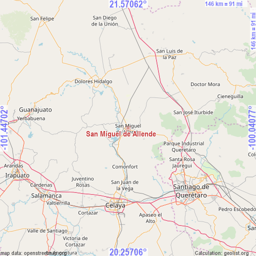
| Upper-left | 21.57062°, | -101.44702° |
| Center: | 20.91528°, | -100.74389° |
| Lower-right: | 20.25706°, | -100.04077° |
| Map W x H: | 146.1×146.1 km | = 90.8×90.8mi |
| max Lat: | 32.7° ⇑24.9% North |
| San Miguel de Allende: | 20.91528° |
| min Lat: | ⇓75.1% South 14.53588° |
| min Long | San Miguel de A | max Long |
| -117.105° | -100.74389° | -86.73105° |
| W 28.6%⇐ | ⇒71.4% E |
Elevation
Elevation of San Miguel de Allende is 1917 m = 6289 ft, and this is 663.3 m = 2176 ft above average elevation for this country.
| Max E: |
3497 m = 11473 ft | 30.4% |
| San Miguel de Allende | 1917 m 6289 ft | |
| Avg. | 1253.7 m = 4113 ft | |
Min E: |
-1 m = -3 ft | 69.6% |
See also: San Miguel de Allende elevation on elevation.city.
Geographical zone
San Miguel de Allende is located in North Torrid zone (between Equator and Tropic of Cancer). Distance of this Northern Tropic circle is 280.4 km =174.2 mi to North.| Distance of | km | miles | from San Miguel de Allende |
|---|---|---|---|
| North Pole | 7681.5 | 4773.1 | to North |
| Arctic Circle | 5075.6 | 3153.8 | to North |
| Tropic Cancer | 280.4 | 174.2 | to North |
| Equator | 2325.6 | 1445.1 | to South |


Nearby cities:
15 places around San Miguel de Allende: (largest is in red/bold)
• Alcocer
6.6 km =4.1 mi,  141°
141°
• Colonia San Luis Rey
2.4 km =1.5 mi,  19°
19°
• Esperanza
4.5 km =2.8 mi,  280°
280°
• Francisco Villa [Fraccionamiento]
2.8 km =1.7 mi, 22°
• Insurgentes
2.7 km =1.7 mi,  14°
14°
• La Cieneguita
5.9 km =3.7 mi,  305°
305°
• La Lomita
2.7 km =1.7 mi, 19°
• Lomas de San José
5 km =3.1 mi,  328°
328°
• Los López
4.9 km =3 mi,  294°
294°
• Montes de Loreto
2.1 km =1.3 mi,  27°
27°
• Nigromante
6.4 km =4 mi,  323°
323°
• Palmita de Landeta
4.2 km =2.6 mi,  87°
87°
• San Miguel Viejo
3.9 km =2.4 mi,  258°
258°
• Santa Cecilia
2.1 km =1.3 mi, 19°
• Santa Teresita de Don Diego
5.3 km =3.3 mi,  222°
222°
Sources, notices
• [Note1] Compared only with cities in Mexico existing in our database
• [Src1] Map data: © OpenStreetMap contributors (CC-BY-SA)
• [Src2] Other city data from geonames.org with taken over terms of usage.
• [Src3] Geographical zone / Annual Mean Temperature by Robert A. Rohde @ Wikipedia
