San Diego del Llanito geodata
San Diego del Llanito (Guanajuato) is a populated place; located in Mexico in America/Mexico_City (GMT-6) time zone. With population of 748 people, there are 11708 cities with bigger population in this country. Compared to other cities in Mexico, 78.5% of cities are located further ↓South; 73% of cities are located further →East and 71.2% of cities have lower elevation than San Diego del Llanito. Note1
Administrative division(s):
- Level 1: Guanajuato
- Level 2: Dolores Hidalgo Cuna de la Independencia Nacional
Current local time in San Diego del Llanito:
08:30 AM, WednesdayDifference from your time zone: hours


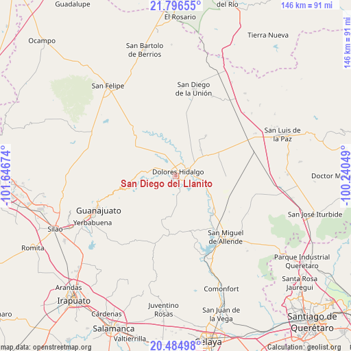
San Diego del Llanito GPS coordinates[2]
21° 8' 31.992" North, 100° 56' 36.996" West
| Map corner | latitude | longitude |
|---|---|---|
| Upper-left | 21.79655°, | -101.64674° |
| Center: | 21.14222°, | -100.94361° |
| Lower-right: | 20.48498°, | -100.24049° |
| Map W x H: | 145.8×145.8 km | = 90.6×90.6mi |
| max Lat: | 32.7° ⇑21.5% North |
| San Diego del Llanito: | 21.14222° |
| min Lat: | ⇓78.5% South 14.53588° |
| min Long | San Diego del L | max Long |
| -117.105° | -100.94361° | -86.73105° |
| W 27%⇐ | ⇒73% E |
Elevation
Elevation of San Diego del Llanito is 1950 m = 6398 ft, and this is 696.3 m = 2284 ft above average elevation for this country.
| Max E: |
3497 m = 11473 ft | 28.8% |
| San Diego del Llanito | 1950 m 6398 ft | |
| Avg. | 1253.7 m = 4113 ft | |
Min E: |
-1 m = -3 ft | 71.2% |
See also: Mexico elevation on elevation.city.
Geographical zone
San Diego del Llanito is located in North Torrid zone (between Equator and Tropic of Cancer). Distance of this Northern Tropic circle is 255.1 km =158.5 mi to North.| Distance of | km | miles | from San Diego del Llanito |
|---|---|---|---|
| North Pole | 7656.3 | 4757.4 | to North |
| Arctic Circle | 5050.4 | 3138.2 | to North |
| Tropic Cancer | 255.1 | 158.5 | to North |
| Equator | 2350.8 | 1460.7 | to South |


Nearby cities:
15 places around San Diego del Llanito: (largest is in red/bold)
• Colonia Francisco I. Madero
3 km =1.9 mi,  303°
303°
• Colonia Padre Hidalgo
3.3 km =2.1 mi,  14°
14°
• Dolores Hidalgo Cuna de la Independencia Nacional
1.9 km =1.2 mi,  36°
36°
• Ejido Dolores
2.7 km =1.7 mi, 9°
• Ejido Jesús María
3.3 km =2.1 mi,  90°
90°
• El Gallinero
4.7 km =2.9 mi,  339°
339°
• El Llanito
2.4 km =1.5 mi,  198°
198°
• La Cantera
6.1 km =3.8 mi,  274°
274°
• La Cruz del Padre Razo (Las Crucitas)
5.1 km =3.2 mi,  22°
22°
• La Erre
5.5 km =3.4 mi,  147°
147°
• La Ventilla
3.2 km =2 mi,  161°
161°
• Río Laja
7.1 km =4.4 mi, 17°
• San José de la Palma
5.4 km =3.4 mi,  184°
184°
• Sebastián
6.1 km =3.8 mi,  65°
65°
• Xoconoxtlito del Llanito
2.1 km =1.3 mi,  238°
238°
Sources, notices
• [Note1] Compared only with cities in Mexico existing in our database
• [Src1] Map data: © OpenStreetMap contributors (CC-BY-SA)
• [Src2] Other city data from geonames.org with taken over terms of usage.
• [Src3] Geographical zone / Annual Mean Temperature by Robert A. Rohde @ Wikipedia
