Sebastián geodata
Sebastián (Guanajuato) is a populated place; located in Mexico in America/Mexico_City (GMT-6) time zone. With population of 745 people, there are 11760 cities with bigger population in this country. Compared to other cities in Mexico, 78.8% of cities are located further ↓South; 72.6% of cities are located further →East and 69.1% of cities have lower elevation than Sebastián. Note1
Administrative division(s):
- Level 1: Guanajuato
- Level 2: Dolores Hidalgo Cuna de la Independencia Nacional


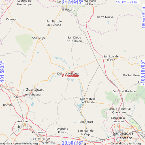
Sebastián GPS coordinates[2]
21° 9' 53.712" North, 100° 53' 24.612" West
| Map corner | latitude | longitude |
|---|---|---|
| Upper-left | 21.81915°, | -101.5933° |
| Center: | 21.16492°, | -100.89017° |
| Lower-right: | 20.50778°, | -100.18705° |
| Map W x H: | 145.8×145.8 km | = 90.6×90.6mi |
| max Lat: | 32.7° ⇑21.2% North |
| Sebastián: | 21.16492° |
| min Lat: | ⇓78.8% South 14.53588° |
| min Long | Sebastián | max Long |
| -117.105° | -100.89017° | -86.73105° |
| W 27.4%⇐ | ⇒72.6% E |
Elevation
Elevation of Sebastián is 1910 m = 6266 ft, and this is 656.3 m = 2153 ft above average elevation for this country.
| Max E: |
3497 m = 11473 ft | 30.9% |
| Sebastián | 1910 m 6266 ft | |
| Avg. | 1253.7 m = 4113 ft | |
Min E: |
-1 m = -3 ft | 69.1% |
See also: Mexico elevation on elevation.city.
Geographical zone
Sebastián is located in North Torrid zone (between Equator and Tropic of Cancer). Distance of this Northern Tropic circle is 252.6 km =157 mi to North.| Distance of | km | miles | from Sebastián |
|---|---|---|---|
| North Pole | 7653.7 | 4755.8 | to North |
| Arctic Circle | 5047.9 | 3136.6 | to North |
| Tropic Cancer | 252.6 | 157 | to North |
| Equator | 2353.3 | 1462.3 | to South |


Nearby cities:
15 places around Sebastián: (largest is in red/bold)
• Adjuntas del Río
5.8 km =3.6 mi,  156°
156°
• Colonia Padre Hidalgo
4.7 km =2.9 mi,  277°
277°
• Dolores Hidalgo Cuna de la Independencia Nacional
4.5 km =2.8 mi,  257°
257°
• Ejido Dolores
5.1 km =3.2 mi,  271°
271°
• Ejido Jesús María
3.4 km =2.1 mi,  221°
221°
• El Gallinero
7.5 km =4.7 mi, 284°
• El Llanito
8 km =5 mi,  232°
232°
• La Cruz del Padre Razo (Las Crucitas)
4.2 km =2.6 mi,  301°
301°
• La Erre
7.6 km =4.7 mi,  199°
199°
• La Ventilla
7.1 km =4.4 mi, 219°
• Rancho el Calvarito
5.8 km =3.6 mi,  330°
330°
• Río Laja
5.5 km =3.4 mi,  321°
321°
• San Diego del Llanito
6.1 km =3.8 mi,  245°
245°
• San Gabriel
6.9 km =4.3 mi,  124°
124°
• Santa Clara
4.5 km =2.8 mi,  142°
142°
Sources, notices
• [Note1] Compared only with cities in Mexico existing in our database
• [Src1] Map data: © OpenStreetMap contributors (CC-BY-SA)
• [Src2] Other city data from geonames.org with taken over terms of usage.
• [Src3] Geographical zone / Annual Mean Temperature by Robert A. Rohde @ Wikipedia
