La Ventilla geodata
La Ventilla (Guanajuato) is a populated place; located in Mexico in America/Mexico_City (GMT-6) time zone. With population of 637 people, there are 13597 cities with bigger population in this country. Compared to other cities in Mexico, 78.1% of cities are located further ↓South; 72.9% of cities are located further →East and 69.8% of cities have lower elevation than La Ventilla. Note1
Administrative division(s):
- Level 1: Guanajuato
- Level 2: Dolores Hidalgo Cuna de la Independencia Nacional


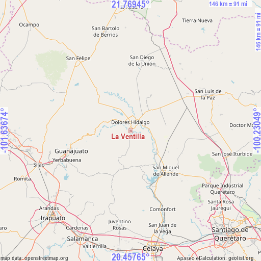
La Ventilla GPS coordinates[2]
21° 6' 54" North, 100° 56' 0.996" West
| Map corner | latitude | longitude |
|---|---|---|
| Upper-left | 21.76945°, | -101.63674° |
| Center: | 21.115°, | -100.93361° |
| Lower-right: | 20.45765°, | -100.23049° |
| Map W x H: | 145.9×145.9 km | = 90.7×90.7mi |
| max Lat: | 32.7° ⇑21.9% North |
| La Ventilla: | 21.115° |
| min Lat: | ⇓78.1% South 14.53588° |
| min Long | La Ventilla | max Long |
| -117.105° | -100.93361° | -86.73105° |
| W 27.1%⇐ | ⇒72.9% E |
Elevation
Elevation of La Ventilla is 1920 m = 6299 ft, and this is 666.3 m = 2186 ft above average elevation for this country.
| Max E: |
3497 m = 11473 ft | 30.2% |
| La Ventilla | 1920 m 6299 ft | |
| Avg. | 1253.7 m = 4113 ft | |
Min E: |
-1 m = -3 ft | 69.8% |
See also: Mexico elevation on elevation.city.
Geographical zone
La Ventilla is located in North Torrid zone (between Equator and Tropic of Cancer). Distance of this Northern Tropic circle is 258.2 km =160.4 mi to North.| Distance of | km | miles | from La Ventilla |
|---|---|---|---|
| North Pole | 7659.3 | 4759.3 | to North |
| Arctic Circle | 5053.4 | 3140 | to North |
| Tropic Cancer | 258.2 | 160.4 | to North |
| Equator | 2347.8 | 1458.9 | to South |


Nearby cities:
15 places around La Ventilla: (largest is in red/bold)
• Adjuntas del Río
6.8 km =4.2 mi,  88°
88°
• Colonia Francisco I. Madero
5.9 km =3.7 mi,  323°
323°
• Colonia Padre Hidalgo
6.2 km =3.9 mi,  358°
358°
• Dolores Hidalgo Cuna de la Independencia Nacional
4.6 km =2.9 mi,  1°
1°
• Ejido Dolores
5.7 km =3.5 mi,  353°
353°
• Ejido Jesús María
3.8 km =2.4 mi,  37°
37°
• El Llanito
1.9 km =1.2 mi,  291°
291°
• La Cantera
7.9 km =4.9 mi,  296°
296°
• La Cruz del Padre Razo (Las Crucitas)
7.8 km =4.8 mi,  6°
6°
• La Erre
2.5 km =1.6 mi,  130°
130°
• San Diego del Llanito
3.2 km =2 mi,  341°
341°
• San José de la Palma
2.8 km =1.7 mi,  211°
211°
• Santa Clara
7.5 km =4.7 mi,  74°
74°
• Sebastián
7.1 km =4.4 mi, 39°
• Xoconoxtlito del Llanito
3.4 km =2.1 mi, 304°
Sources, notices
• [Note1] Compared only with cities in Mexico existing in our database
• [Src1] Map data: © OpenStreetMap contributors (CC-BY-SA)
• [Src2] Other city data from geonames.org with taken over terms of usage.
• [Src3] Geographical zone / Annual Mean Temperature by Robert A. Rohde @ Wikipedia
