Zapotal geodata
Zapotal (Veracruz) is a populated place; located in Mexico in America/Mexico_City (GMT-6) time zone. With population of 728 people, there are 11990 cities with bigger population in this country. Compared to other cities in Mexico, 60.4% of cities are located further ↓South; 69% of cities are located further ←West and 77.6% of cities have higher elevation than Zapotal. Note1


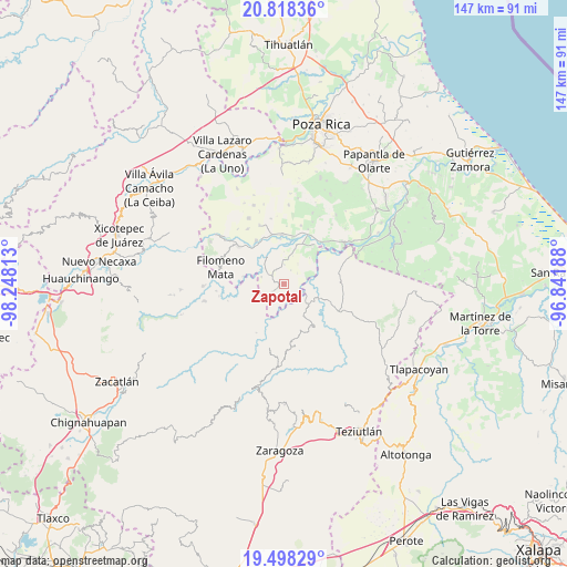
Zapotal GPS coordinates[2]
20° 9' 34.992" North, 97° 32' 42" West
| Map corner | latitude | longitude |
|---|---|---|
| Upper-left | 20.81836°, | -98.24813° |
| Center: | 20.15972°, | -97.545° |
| Lower-right: | 19.49829°, | -96.84188° |
| Map W x H: | 146.8×146.8 km | = 91.2×91.2mi |
| max Lat: | 32.7° ⇑39.6% North |
| Zapotal: | 20.15972° |
| min Lat: | ⇓60.4% South 14.53588° |
| min Long | Zapotal | max Long |
| -117.105° | -97.545° | -86.73105° |
| W 69%⇐ | ⇒31% E |
Elevation
Elevation of Zapotal is 139 m = 456 ft, and this is 1114.7 m = 3657 ft below average elevation for this country.
| Max E: |
3497 m = 11473 ft | 77.6% |
| Avg. | 1253.7 m = 4113 ft | |
| Zapotal | 139 m = 456 ft | |
Min E: |
-1 m = -3 ft | 22.4% |
See also: Mexico elevation on elevation.city.
Geographical zone
Zapotal is located in North Torrid zone (between Equator and Tropic of Cancer). Distance of this Northern Tropic circle is 364.4 km =226.4 mi to North.| Distance of | km | miles | from Zapotal |
|---|---|---|---|
| North Pole | 7765.5 | 4825.3 | to North |
| Arctic Circle | 5159.6 | 3206 | to North |
| Tropic Cancer | 364.4 | 226.4 | to North |
| Equator | 2241.6 | 1392.9 | to South |


Nearby cities:
15 places around Zapotal: (largest is in red/bold)
• Acatzácatl
6.8 km =4.2 mi,  217°
217°
• Anayal Número Uno
2.7 km =1.7 mi,  193°
193°
• Caxuxuman
1.3 km =0.8 mi,  162°
162°
• Chapultepec
5.1 km =3.2 mi,  359°
359°
• Chihuixcruz
3.5 km =2.2 mi,  45°
45°
• Coxquihui
5 km =3.1 mi,  302°
302°
• El Ermitaño
6.3 km =3.9 mi,  33°
33°
• José María Morelos
6.2 km =3.9 mi,  0°
0°
• Reyes de Vallarta
6 km =3.7 mi,  166°
166°
• Sabanas de Xalostoc
7 km =4.3 mi,  8°
8°
• Santa Isabel
4 km =2.5 mi,  24°
24°
• Tahuaxni Norte
3.6 km =2.2 mi,  268°
268°
• Tecuantepec
5 km =3.1 mi,  109°
109°
• Zozocolco de Guerrero
6.7 km =4.2 mi,  202°
202°
• Zozocolco de Hidalgo
3.9 km =2.4 mi,  236°
236°
Sources, notices
• [Note1] Compared only with cities in Mexico existing in our database
• [Src1] Map data: © OpenStreetMap contributors (CC-BY-SA)
• [Src2] Other city data from geonames.org with taken over terms of usage.
• [Src3] Geographical zone / Annual Mean Temperature by Robert A. Rohde @ Wikipedia
