Canindo y Pedregal geodata
Canindo y Pedregal (Michoacán) is a populated place; located in Mexico in America/Mexico_City (GMT-6) time zone. With population of 724 people, there are 12063 cities with bigger population in this country. Compared to other cities in Mexico, 59.6% of cities are located further ↓South; 67.4% of cities are located further →East and 88.6% of cities have lower elevation than Canindo y Pedregal. Note1


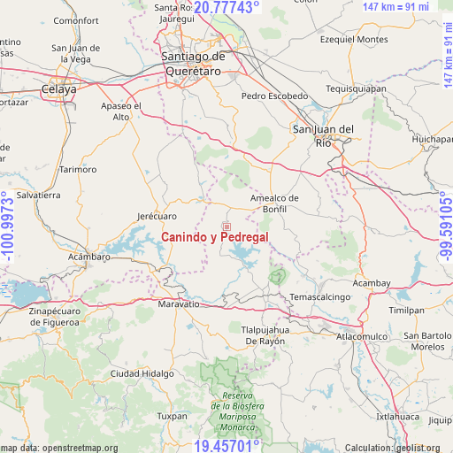
Canindo y Pedregal GPS coordinates[2]
20° 7' 6.996" North, 100° 17' 39.012" West
| Map corner | latitude | longitude |
|---|---|---|
| Upper-left | 20.77743°, | -100.9973° |
| Center: | 20.11861°, | -100.29417° |
| Lower-right: | 19.45701°, | -99.59105° |
| Map W x H: | 146.8×146.8 km | = 91.2×91.2mi |
| max Lat: | 32.7° ⇑40.4% North |
| Canindo y Pedregal: | 20.11861° |
| min Lat: | ⇓59.6% South 14.53588° |
| min Long | Canindo y Pedre | max Long |
| -117.105° | -100.29417° | -86.73105° |
| W 32.6%⇐ | ⇒67.4% E |
Elevation
Elevation of Canindo y Pedregal is 2359 m = 7740 ft, and this is 1105.3 m = 3626 ft above average elevation for this country.
| Max E: |
3497 m = 11473 ft | 11.4% |
| Canindo y Pedregal | 2359 m 7740 ft | |
| Avg. | 1253.7 m = 4113 ft | |
Min E: |
-1 m = -3 ft | 88.6% |
See also: Mexico elevation on elevation.city.
Geographical zone
Canindo y Pedregal is located in North Torrid zone (between Equator and Tropic of Cancer). Distance of this Northern Tropic circle is 368.9 km =229.2 mi to North.| Distance of | km | miles | from Canindo y Pedregal |
|---|---|---|---|
| North Pole | 7770.1 | 4828.1 | to North |
| Arctic Circle | 5164.2 | 3208.9 | to North |
| Tropic Cancer | 368.9 | 229.2 | to North |
| Equator | 2237 | 1390 | to South |


Nearby cities:
15 places around Canindo y Pedregal: (largest is in red/bold)
• Cerro Colorado
14.4 km =8.9 mi,  334°
334°
• Chiteje de la Cruz
14.9 km =9.3 mi,  75°
75°
• Chitejé de Garabato
11.2 km =7 mi,  100°
100°
• Coroneo
11.7 km =7.3 mi,  320°
320°
• Dolores
7.1 km =4.4 mi,  204°
204°
• El Capulín
14.2 km =8.8 mi, 328°
• El Varal
11.1 km =6.9 mi,  93°
93°
• Epitacio Huerta
1.8 km =1.1 mi,  3°
3°
• Guadalupe el Terrero
15.3 km =9.5 mi, 89°
• La Huerta
14.2 km =8.8 mi,  307°
307°
• La Soledad
12.2 km =7.6 mi,  62°
62°
• Llano Largo (Santa Rosa de Lima)
15.3 km =9.5 mi,  133°
133°
• San Antonio Molinos
9.6 km =6 mi,  120°
120°
• Temascales (El Jacal)
14.8 km =9.2 mi, 118°
• Tepuxtepec
15.9 km =9.9 mi,  153°
153°
Sources, notices
• [Note1] Compared only with cities in Mexico existing in our database
• [Src1] Map data: © OpenStreetMap contributors (CC-BY-SA)
• [Src2] Other city data from geonames.org with taken over terms of usage.
• [Src3] Geographical zone / Annual Mean Temperature by Robert A. Rohde @ Wikipedia
